- Usage in publication:
-
- Lead Gulch formation*
- Modifications:
-
- Named
- Dominant lithology:
-
- Limestone
- Siltstone
- Dolomite
- Chert
- AAPG geologic province:
-
- Great Basin province
Summary:
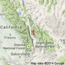
Named for exposures in Lead Gulch, a short tributary of Mazourka Canyon. Type section designated on spur along east wall of Mazourka Canyon, 7500 ft S85E from SE corner sec 36, T11S, R7E, Independence quad, Inyo County, CA. Consists of limestone, siltstone, dolomite, chert, and shale interlayered in regular-bedded sequence (beds commonly 1/2 to 2 in thick). Thinly laminated siltstone, weathering bright orange and red, and blue-gray to medium-gray limestone are dominant lithologies. Distinctive fissile olive-brown to dark-green shale (or metamorphic equivalent) occupies up to 20 ft at base of sections. Thickness at type, 280 ft (probable maximum thickness for formation 300 ft). Contact with underlying Bonanza King Formation probably conformable; contact with overlying Tamarack Canyon Dolomite definitely conformable. Is Late Cambrian based on fossil evidence.
Source: GNU records (USGS DDS-6; Menlo GNULEX).
For more information, please contact Nancy Stamm, Geologic Names Committee Secretary.
Asterisk (*) indicates published by U.S. Geological Survey authors.
"No current usage" (†) implies that a name has been abandoned or has fallen into disuse. Former usage and, if known, replacement name given in parentheses ( ).
Slash (/) indicates name conflicts with nomenclatural guidelines (CSN, 1933; ACSN, 1961, 1970; NACSN, 1983, 2005, 2021). May be explained within brackets ([ ]).

