- Usage in publication:
-
- Lead Camp Limestone*
- Modifications:
-
- Named
- Dominant lithology:
-
- Limestone
- Shale
- AAPG geologic province:
-
- Orogrande basin
Summary:
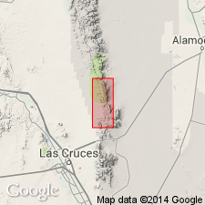
Named for canyon in southern San Andres Mountains, eastern Dona Ana Co, NM, Orogrande basin. Type section designated near junction of Lead Camp and San Andres Canyons on north side of San Andres Canyon in NW1/4 sec 19, T18S, R4E. Unit is a cliff-forming limestone capping southern San Andres Mountains; forms a dip slope from crest of range westward; width of outcrop ranges from 1,000 ft to 1.25 mi. Consists of 75 percent cherty, clastic, medium- to dark-gray limestone that weathers medium gray to brown; 21-24 percent calcareous shale, some of which contains marine fossils; and minor sandstone and conglomerate at base. Thickness ranges from 861 ft at type, thinning southward to 320 ft in Little San Nicholas Canyon (though thinning may be local as 50 mi to south in Franklin Mountains, rocks of equivalent age are about 1,600 ft thick). Unconformably overlies Rancheria Formation; conformably underlies Panther Seep Formation. Geologic map; measured section. Is in part equivalent to Sandia Formation and lower gray limestone member of Madera Formation in central NM and La Tuna, Berino and Bishops Cap Members of Magdalena Formation in Franklin Mountains and may include rocks equivalent in part to both Red House and Nakaye Formations in Caballo Mountains and Gobbler and Beeman Formations in Sacramento Mountains. Based on fusulinids, unit was deposited during Morrow? to early Missouri (Early? to Late Pennsylvanian) time.
Source: GNU records (USGS DDS-6; Denver GNULEX).
For more information, please contact Nancy Stamm, Geologic Names Committee Secretary.
Asterisk (*) indicates published by U.S. Geological Survey authors.
"No current usage" (†) implies that a name has been abandoned or has fallen into disuse. Former usage and, if known, replacement name given in parentheses ( ).
Slash (/) indicates name conflicts with nomenclatural guidelines (CSN, 1933; ACSN, 1961, 1970; NACSN, 1983, 2005, 2021). May be explained within brackets ([ ]).

