

- Usage in publication:
-
- Lay Dam Formation
- Modifications:
-
- Named
- Dominant lithology:
-
- Graywacke
- Slate
- Phyllite
- AAPG geologic province:
-
- Piedmont-Blue Ridge province
Summary:
Named Lay Dam Formation of the Talladega Group for gray-green to black, bouldery graywacke with intercalated slate and phyllite. Thickness ranges from 1800-3600 m. Unit includes the Miller Mill Quartzite and Kalona Quartzite Members. The Lay Dam Formation underlies the upper portion of the Butting Ram Sandstone and is considered of Early Devonian age.
Source: GNU records (USGS DDS-6; Reston GNULEX).
- Usage in publication:
-
- Lay Dam Formation
- Modifications:
-
- Revised
- AAPG geologic province:
-
- Piedmont-Blue Ridge province
Summary:
Lay Dam Formation is subdivided into Cheaha Quartzite Member and Erin Slate Member (reduced from formation rank). Underlies Butting Ram Sandstone. Unconformably overlies Sylacauga Marble Group. Age given as Devonian.
Source: GNU records (USGS DDS-6; Reston GNULEX).

- Usage in publication:
-
- Lay Dam Formation*
- Modifications:
-
- Revised
- AAPG geologic province:
-
- Piedmont-Blue Ridge province
Summary:
The Lay Dam Formation of Carrington (1972) of the Talladega Group in the Talladega thrust slice in the Rome thrust sheet in northern AL is accepted by the USGS. It includes the Cheaha Quartzite Member. Discordantly overlies lower Paleozoic (mostly Knox Group) rocks of the carbonate shelf sequence in the Rome thrust sheet, and underlies Butting Ram Sandstone. Age is Early Devonian.
Source: GNU records (USGS DDS-6; Reston GNULEX).

- Usage in publication:
-
- Lay Dam Formation
- Modifications:
-
- Overview
- AAPG geologic province:
-
- Piedmont-Blue Ridge province
Summary:
Lay Dam Formation of Talladega Group consists of polymictic greenish-gray thick and irregularly bedded metaclastics (graywacke, siltstone, sandstone, and arkose). May include thin zones of chlorite schist, graphite slate and bluish-gray to grayish-orange silty limestone. Contains quartzite beds and a conglomeratic facies of bouldery metagraywacke with clasts up to 3 ft in diameter in Coosa and Chilton Cos. In Cleburne and Calhoun Cos, the Lay Dam includes rocks previously assigned to the Abel Gap Formation of Bearce (1973), which consist of interbedded greenish-gray metasiltstone and quartzite, black phyllitic metasiltstone, medium-gray to greenish-gray arkosic quartzite, and dark-gray pyritic quartzite. Includes three members: the Miller Mill Quartzite Member, the Erin Slate Member and the Cheaha Quartzite Member. A significant regional angular unconformity is present at the base of the Lay Dam. Age is Silurian(?) to Devonian(?).
Source: GNU records (USGS DDS-6; Reston GNULEX).

- Usage in publication:
-
- Lay Dam Formation*
- Modifications:
-
- Age modified
- Biostratigraphic dating
- AAPG geologic province:
-
- Piedmont-Blue Ridge province
Summary:
Conodonts from the top of the Lay Dam Formation and fossils from the stratigraphically higher Jemison Chert, both of the Talladega Group, restrict the age of the upper Lay Dam to Silurian to Early Devonian. These and other conodonts discovered at Carara in the Sylacauga Marble Group constrain the age of the unconformity at the base of the Lay Dam to late Early Ordovician to Early Devonian. The entire Lay Dam sequence was probably rapidly deposited and the diamictite facies is found both at the base and the top of the unit, making it likely that the entire Lay Dam is as young as Silurian or Early Devonian.
Source: GNU records (USGS DDS-6; Reston GNULEX).
- Usage in publication:
-
- Lay Dam Formation
- Modifications:
-
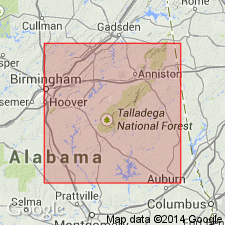
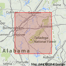
- Areal extent
- Overview
- AAPG geologic province:
-
- Piedmont-Blue Ridge province
Summary:
Extent of unit not well defined because of concealment below Mesozoic sediments of Gulf Coastal Plain and lack of detailed mapping to the northeast. Lay Dam is at least partly correlative with Heflin Phyllite of Cleburne Co. Unit may extend into Talladega belt of GA and perhaps can be correlated with Mineral Bluff Formation of GA and NC. Probable age range is Silurian to Early Devonian; unlikely that lower part is as old as Middle or Late Ordovician.
Source: GNU records (USGS DDS-6; Reston GNULEX).
- Usage in publication:
-
- Lay Dam Formation
- Modifications:
-
- Overview
- AAPG geologic province:
-
- Piedmont-Blue Ridge province
Summary:
Lay Dam Formation lithologically resembles the Heflin phyllite (of Bearce, 1973). Both formations are stratigraphically overlain by the Cheaha Quartzite (Butts, 1926) (Abel Gap Formation of Bearce, 1973). The Lay Dam unconformably overlies units as young as Early Ordovician, most noticeably the Sylacauga Marble Group. The Heflin-Chilhowee contact may also be unconformable, and if so, the Heflin should probably be renamed Lay Dam.
Source: GNU records (USGS DDS-6; Reston GNULEX).
For more information, please contact Nancy Stamm, Geologic Names Committee Secretary.
Asterisk (*) indicates published by U.S. Geological Survey authors.
"No current usage" (†) implies that a name has been abandoned or has fallen into disuse. Former usage and, if known, replacement name given in parentheses ( ).
Slash (/) indicates name conflicts with nomenclatural guidelines (CSN, 1933; ACSN, 1961, 1970; NACSN, 1983, 2005, 2021). May be explained within brackets ([ ]).