

- Usage in publication:
-
- Lawson Creek Formation*
- Modifications:
-
- Named
- Paleomagnetics
- Dominant lithology:
-
- Siltstone
- Argillite
- Quartzite
- AAPG geologic province:
-
- Northern Rocky Mountain region
Summary:
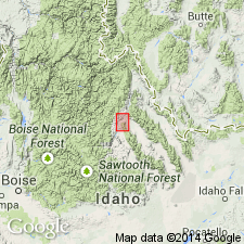
Named for Lawson Creek in the Lost River Range, Custer Co, ID in Northern Rocky Mountain region. Exposures in secs 4 and 9, T14N, R21E are designated the type locality. Consists predominately of medium-reddish-purple to dark-purplish-gray and maroon quartzite, impure quartzite, siltstone, and argillite. Predominately thin bedded. Abundant mud-chip breccia, ripple marks, and micaceous partings. Divisible into 3 units. About l,300 m have been measured. Conformably overlies Proterozoic Y Swauger Formation; underlies Eocene Challis Volcanics. Proterozoic Y or middle Proterozoic age assigned. Known in four localities in Lost River Range. Thought to be correlative of upper part of Missoula Group of Belt Supergroup of Belt basin. Has normal and reversed polarities at Anderson Spring (loc B, fig. 2) that are identical to directions reported for Missoula Group.
Source: GNU records (USGS DDS-6; Denver GNULEX).
- Usage in publication:
-
- Lawson Creek Formation*
- Modifications:
-
- Areal extent
- AAPG geologic province:
-
- Northern Rocky Mountain region
Summary:
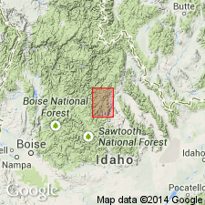
Gradationally and conformably overlies Swauger Formation in northern part of Lost River Range in Custer and Butte Cos, ID in the Northern Rocky Mountain region west of the Lemhi Range, but is not recognized elsewhere. More than 1,200 m exposed. Top concealed under Challis Volcanics. Of Middle Proterozoic age.
Source: GNU records (USGS DDS-6; Denver GNULEX).
For more information, please contact Nancy Stamm, Geologic Names Committee Secretary.
Asterisk (*) indicates published by U.S. Geological Survey authors.
"No current usage" (†) implies that a name has been abandoned or has fallen into disuse. Former usage and, if known, replacement name given in parentheses ( ).
Slash (/) indicates name conflicts with nomenclatural guidelines (CSN, 1933; ACSN, 1961, 1970; NACSN, 1983, 2005, 2021). May be explained within brackets ([ ]).