

- Usage in publication:
-
- Lavender shale member
- Modifications:
-
- Named
- Dominant lithology:
-
- Shale
- Limestone
- AAPG geologic province:
-
- Appalachian basin
Summary:
Lavender shale member, named in this report, described as dark compact massively bedded calcareous shale or argillaceous limestone with small amount of limy material interbedded in Fort Payne chert. Thickness about 50 ft. Overlain by chert locally as much as 50 ft thick. In some areas rests directly on Chattanooga shale. Age is Mississippian.
Source: GNU records (USGS DDS-6; Reston GNULEX).
- Usage in publication:
-
- Lavender member
- Modifications:
-
- Redescribed
- AAPG geologic province:
-
- Appalachian basin
Summary:
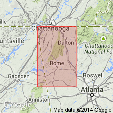
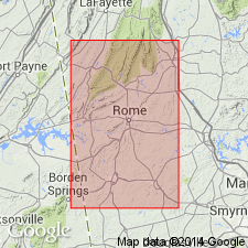
Lavender shale not readily separable from dark-colored siliceous argillaceous limestone that occurs with and above it. Much of what Butts called shale is actually limestone. Therefore, the dark-colored siliceous, argillaceous limestone in lower two-thirds of the Fort Payne, together with the associated calcareous shale is referred to in this report as Lavender member. Thickness of Lavender member appears to be reciprocally related to thickness of bedded chert. One mi south of West Rome, 30 to 50 ft of bedded chert is overlain by 80 to 100 ft of Lavender member, but 15 mi north, near Gore, about 150 ft of chert is exposed and Lavender member is missing.
Source: GNU records (USGS DDS-6; Reston GNULEX).
- Usage in publication:
-
- Lavender Shale Member*
- Modifications:
-
- Overview
- AAPG geologic province:
-
- Appalachian basin
Summary:
Lavender Shale Member of Butts and Gildersleeve (1948) used in this report. Age is Early Mississippian
Source: GNU records (USGS DDS-6; Reston GNULEX).
For more information, please contact Nancy Stamm, Geologic Names Committee Secretary.
Asterisk (*) indicates published by U.S. Geological Survey authors.
"No current usage" (†) implies that a name has been abandoned or has fallen into disuse. Former usage and, if known, replacement name given in parentheses ( ).
Slash (/) indicates name conflicts with nomenclatural guidelines (CSN, 1933; ACSN, 1961, 1970; NACSN, 1983, 2005, 2021). May be explained within brackets ([ ]).