

- Usage in publication:
-
- Lava Dam Member*
- Modifications:
-
- Original reference
- Biostratigraphic dating
- Dominant lithology:
-
- Limestone
- Mudstone
- AAPG geologic province:
-
- Great Basin province
- South Western Overthrust
Summary:
Pg. 3 (fig. 2), 6-7, 16 (fig. 6), 20+ (measured sections), pl. 1 (corr. chart). Lava Dam Member of Notch Peak Formation. Mostly stromatolitic limestones and lime mudstones. Usually forms resistant cliffs and ledges, notably in the House Range and Wah Wah Mountains. Thickness 364 feet (110.9 m) at type section, 437 feet (133.2 m) at reference section. Is uppermost member of the Notch Peak Formation. Overlies Red Tops Member (new) of Notch Peak Formation and underlies House Limestone. Age equivalent of parts of Chokecherry Dolomite of Deep Creek Range, Dugway Ridge Dolomite of Dugway Range, and Ajax Dolomite of Sheeprock and East Tintic Mountains. Fossils [listed]. Contains faunas of (ascending): trilobite zones SAUKIA, MISSISQUOIA, and lower part of SYMPHYSURINA (subzones SAUKIELLA SEROTINA to lower part of SYMPHYSURINA BREVISPICATA); and conodont zones PROCONODONTUS and CORDYLODUS PROAVUS (subzones CAMBROOISTODUS MINUTUS to lower part of HIRSUTODONTUS SIMPLEX). Age is Late Cambrian to Early Ordovician (late Croixan to early Canadian).
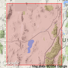
Type section (=principal reference section of Notch Peak Formation): [Sneakover Pass area], in sec. 5 [unsurveyed], T. 20 S., R. 13 W., Notch Peak 15-min quadrangle, central House Range, Millard Co., central western UT.
Reference section: Lawson Cove section, in E/2 sec. 4, T. 25 S., R. 15 W., Wah Wah Summit 15-min quadrangle, Gray Hills area, Wah Wah Mountains, Millard Co., central western UT.
Named from outcrops on both north and south sides of the "Lava Dam," a geologic feature shown by L.F. Hintze, 1974 (USGS Misc. Field Studies Map MF-633, sheet 1, C'-C" cross section), in [SE/4] sec. 6, T. 23 S., R. 13 W., The Barn 15-min quadrangle, central House Range, Millard Co., central western UT.
Source: Publication.
- Usage in publication:
-
- Lava Dam Member*
- Modifications:
-
- Revised
- Biostratigraphic dating
- AAPG geologic province:
-
- Great Basin province
- South Western Overthrust
Miller, J.F., Evans, K.R., Loch, J.D., Ethington, R.L., and Stitt, J.H., 2001, New lithostratigraphic units in the Notch Peak and House Formations (Cambrian-Ordovician), Ibex area, western Millard County, Utah: Brigham Young University Geology Studies, v. 46, p. 35-69.
Summary:
Pg. 36 (fig. 1), 38 (fig. 3), 40, 42-43, 48+ (measured sections). Lava Dam Member of Notch Peak Formation. Revised to include two newly named limestone marker beds (descending) Lawson Cove Bed and Tank Canyon Bed (= unit 26 of Hintze and others, 1988, USGS Prof. Paper 1393, p. 21), which are separated by about 25 feet (7.6 m) of limestones, mudstones, and conglomerates. Both beds recognized in the Wah Wah Mountains and House Range, Millard County, western Utah. Lava Dam is uppermost member of Notch Peak Formation; overlies Red Tops Member. Underlies Barn Canyon Member (new), lowermost member of House Limestone. Contact between the Notch Peak and House formations placed above a widespread thin trilobite coquina bed with abundant SYMPHYSURINA and below a distinctive interval of limestone that has 30 to 50 percent white to brown to black chert. Contact is conformable throughout northern Wah Wah Mountains and southern to central House Range, but it is unconformable in northern Drum Mountains. Unconformity is widepsread in areas north of Drum Mountains. Fossils [listed]. Age is considered Late Cambrian to Early Ordovician (late Millardan to early Ibexian, Sunwaptan to early Skullrockian), following Cambrian classification of Palmer, 1998 (Canadian Jour. Earth Sci., v. 35, p. 323-328) and Ibexian classification of Ross and others, 1997 (USGS Prof. Paper 1579). [Fig. 1 shows the Lava Dam ranging from EOCONODONTUS to basal CORDYLODUS INTERMEDIUS conodont zone (CAMBROOISTODUS MINUTUS to basal HIRSUTODONTUS SIMPLEX subzone), SAUKIA to basal SYMPHYSURINA trilobite zone (tentatively uppermost SAUKIELLA JUNIA to basal SYMPHYSURINA BREVISPICATA subzone).]
Source: Publication.
For more information, please contact Nancy Stamm, Geologic Names Committee Secretary.
Asterisk (*) indicates published by U.S. Geological Survey authors.
"No current usage" (†) implies that a name has been abandoned or has fallen into disuse. Former usage and, if known, replacement name given in parentheses ( ).
Slash (/) indicates name conflicts with nomenclatural guidelines (CSN, 1933; ACSN, 1961, 1970; NACSN, 1983, 2005, 2021). May be explained within brackets ([ ]).