

- Usage in publication:
-
- Laurel Canyon Granodiorite*
- Modifications:
-
- Named
- Dominant lithology:
-
- Granodiorite
- AAPG geologic province:
-
- Southwestern Basin-and-Range region
Summary:
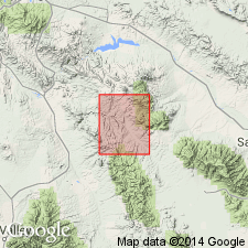
Named for good exposures along Laurel Canyon in northwest part of T6S, R20E, Graham Co, AZ in Southwestern Basin-and-Range region. Several small outliers. Moderately resistant to erosion. Occupies about 10 sq mi of quad. No type locality designated. Varies considerably but is most commonly a gray or pinkish-gray, coarse-grained porphyritic granodiorite with large phenocrysts of pink potassium feldspar. Detailed petrologic description. Intrudes Pinal Schist (Precambrian). Unconformably overlain by Bolsa Quartzite (Cambrian). Is intruded by diabase and Santa Teresa Granite. Assigned an early Precambrian age. Geologic map.
Source: GNU records (USGS DDS-6; Denver GNULEX).
For more information, please contact Nancy Stamm, Geologic Names Committee Secretary.
Asterisk (*) indicates published by U.S. Geological Survey authors.
"No current usage" (†) implies that a name has been abandoned or has fallen into disuse. Former usage and, if known, replacement name given in parentheses ( ).
Slash (/) indicates name conflicts with nomenclatural guidelines (CSN, 1933; ACSN, 1961, 1970; NACSN, 1983, 2005, 2021). May be explained within brackets ([ ]).