

- Usage in publication:
-
- Latite Ridge Latite*
- Modifications:
-
- Named
- Dominant lithology:
-
- Latite
- Tuff
- AAPG geologic province:
-
- Wasatch uplift
Summary:
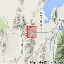
Named as middle of three formations of Tintic Mountain Volcanic Group (new) for its type locality on Latite Ridge, NW1/4 sec 23 and NE1/4 sec 27, T10S, R2W, Utah Co, UT on the Wasatch uplift. Consists of 1) a discontinuous lower member of medium-greenish-gray to white, medium- to fine-textured air-fall tuff and water-laid tuff called the air-fall tuff member; and 2) upper, medium-reddish-brown, mostly fine-grained welded tuff member. Upper member locally grades to brownish black, through lavender to pale pinkish brown to white. Locally overlies Packard Quartz Latite and Copperopolis Latite (new) of Tintic Mountain Volcanic Group; is locally cut by monzonite of Silver City stock. Underlies Big Canyon Latite (new) of Tintic Mountain Volcanic Group unconformably. Due to stratigraphic position, age is fixed at middle Oligocene. Eruptive source believed to be strongly argillaceous intrusive body in Copperopolis Canyon. Lithologic and textural character indicates an initial eruption of mostly fine-grained pyroclastic material--some of which was deposited in lakes or ponds as volcanic tuff and tuff breccia--followed immediately by one or more nuees ardentes; massive character of welded tuff member indicates only one cooling unit, therefore only one general period of eruption. Geologic map, sections, stratigraphic chart.
Source: GNU records (USGS DDS-6; Denver GNULEX).
For more information, please contact Nancy Stamm, Geologic Names Committee Secretary.
Asterisk (*) indicates published by U.S. Geological Survey authors.
"No current usage" (†) implies that a name has been abandoned or has fallen into disuse. Former usage and, if known, replacement name given in parentheses ( ).
Slash (/) indicates name conflicts with nomenclatural guidelines (CSN, 1933; ACSN, 1961, 1970; NACSN, 1983, 2005, 2021). May be explained within brackets ([ ]).