- Usage in publication:
-
- Latir Peak latite
- Modifications:
-
- Named
- Dominant lithology:
-
- Latite
- AAPG geologic province:
-
- San Luis basin
Summary:
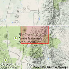
Named for Latir Peak, about T30N, R14E, Latir quad, Taos Co., NM in the San Luis basin. Occurs in scattered exposures from east of Latir Peak to Comanche Creek. Is light-gray to red, porphyritic latite with an aphanitic to glassy groundmass. Contains phenocrysts of plagioclase, quartz, biotite, and hornblende in a groundmass of feldspar and quartz. Occurs as thick flows, dikes, and sills, and is intrusive into andesite tuffs and sediments. The contact of the Latir Peak with these tuffs and sediments is badly fractured and sheared. Is of Tertiary age.
Source: GNU records (USGS DDS-6; Denver GNULEX).

- Usage in publication:
-
- Latir Peak Quartz Latite*
- Modifications:
-
- Redefined
- Redescribed
- Dominant lithology:
-
- Quartz latite
- AAPG geologic province:
-
- San Luis basin
Summary:
Latir Peak Latite (McKinlay, 1956) of late Oligocene age redescribed as Latir Peak Quartz Latite, in the San Luis basin. The chemical data indicate a quartz latitic composition, with SiO[superscript 2] averaging 65-67 percent and normative quartz contents of 20 percent or more. Is a coarsely porphyritic gray or red-brown lava characterized by phenocrysts of blocky plagioclase, hornblende, and/or augite and biotite. Occurs as thick flows and domes mostly in the northeast parts of the Questa caldera. Overlies andesitic flows and underlies the Amalia Tuff. Exceeds 500 m in thickness near Latir Peak. Extrusive origin of the latite interpreted on the basis of presence of associated pyroclastic deposits, well-developed flow breccia, and flow layering, geometry with respect to adjacent volcanic units, and lack of fine-grained cognate mafic inclusions. Age is late Oligocene.
Source: GNU records (USGS DDS-6; Denver GNULEX).
For more information, please contact Nancy Stamm, Geologic Names Committee Secretary.
Asterisk (*) indicates published by U.S. Geological Survey authors.
"No current usage" (†) implies that a name has been abandoned or has fallen into disuse. Former usage and, if known, replacement name given in parentheses ( ).
Slash (/) indicates name conflicts with nomenclatural guidelines (CSN, 1933; ACSN, 1961, 1970; NACSN, 1983, 2005, 2021). May be explained within brackets ([ ]).

