- Usage in publication:
-
- Latah formation*
- Modifications:
-
- Original reference
- Dominant lithology:
-
- Clay
- Shale
- Sand
- Gravel
- AAPG geologic province:
-
- Eastern Columbia basin
Summary:
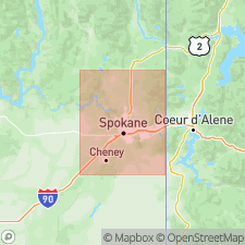
Pg. A4-A12. Latah formation. Chiefly clay and shale, with some beds of sand and gravel and one or more beds that contain sufficient quantities of diatom skeletons to be classed as impure diatomaceous earth. Many shale beds appear to be composed largely of very fine volcanic ash. The shale generally contains plant remains classified by F.H. Knowlton as middle or lower Miocene. [Berry assigned the flora to middle or upper Miocene; R.W. Brown considers it middle Miocene. The formation is mapped in this report as far north as 25+/- miles from Spokane and 10+/- miles south of Spokane.] Evidence indicates it extends eastward into the open valleys near Coeur d'Alene, Idaho. Thickness at least 250 feet in area of typical exposure on slope west of Latah Creek [now Hangman Creek], a short distance south of Spokane; and 0 to 1,500 feet in Spokane-Coeur d'Alene [Idaho] area. In Spokane area, so far as known, it everywhere rests on the granite-schist group, and apparently it is or was at one time everywhere covered by the lava flows comprising the "rim rock," which are somewhat later than Yakima basalt. It formerly extended continuously over the area from Silver Hill-Cheney Ridge north and east to the mountains, except for the "islands" or "steptoes" of crystalline rock, many of which were not covered even by the highest lava flow. To south and west of the ridge the extent of the formation is not definitely known and the upper beds are surely missing.
Source: US geologic names lexicon (USGS Bull. 896, p. 1155).
- Usage in publication:
-
- Latah formation*
- Modifications:
-
- Revised
- AAPG geologic province:
-
- Eastern Columbia basin
Kirkham, V.R.D., and Johnson, M.M., 1929, The Latah formation in Idaho: Journal of Geology, v. 37, no. 5, p. 483-504.
Summary:
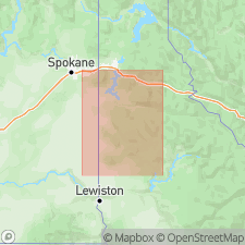
Pg. 483+. Latah formation. The Latah formation at Spokane, Washington, by definition occupies position underlying Columbia River basalt instead of being interstratified with the lava. But plants collected from 7 localities described by Russell are all typical of Latah flora. The formation has been identified in Benewah, Latah, and Nez Perce Counties, Idaho. [Describes exposures at 40 places in these counties.] The material in Idaho differs little from that at Spokane. Although defined in type locality as being essentially a pre-basalt formation, the Latah, as shown by a large number of localities over a much greater area, appears to be more commonly a series interbedded with lava flows of Columbia River basalt. In nearly all Idaho localities the greater part of the series has basalt underlying as well as overlying it. In some places, however, the Latah beds lie directly on the pre-basalt terrain. At all places where this was observed, except at Moscow, higher and thicker members interstratified with the overlying basalt were also present. The beds consist chiefly of fine sediments which contain plant fossils that indicate their Latah age. Where two members of the series are thought to be separated by as much as 400 feet of lava the fossil assemblage shows neither notable break nor evolution, so far as observed. The various members of Latah series as found in Idaho appear to occur within a range of 800 feet. The geographic extent of the series is many times greater than was at first surmised. The lake beds are interstratified with the basalt without angular unconformity, but both basalt and sediments abut unconformably against pre-basalt formations. The greatest measured thickness of any one member in Idaho is 350 +/-feet. At no Idaho locality is the combined thickness of the various sedimentary layers believed to be more than 400 feet. The usual thickness of upper layer is 100 +/-feet, and that of lower layer 150 to 200 feet. [Age is middle or late Miocene.]
Source: US geologic names lexicon (USGS Bull. 896, p. 1155).

- Usage in publication:
-
- Latah formation*
- Modifications:
-
- Revised
- AAPG geologic province:
-
- Eastern Columbia basin
Summary:
Pg. 7-8, pls. 2, 3, 4. Latah formation. In general vicinity of clay deposits in eastern Washington and western Idaho, the Latah is interbedded with Columbia River basalt and is divided into an upper and lower part by the unit of basalt on which residual clay developed. Upper part rests upon residual clay derived from basalt whereas the lower part rests upon unweathered basalt. Consists of unconsolidated lacustrine and fluvial sediments derived from the weathering and erosion of granodiorite and related intrusive rocks in the mountainous areas to the east. Sediments are light gray generally, white or yellow in some places, and red in a few places. They are predominantly kaolinite, with minor quartz gravel, quartz and feldspar sand, and muscovite. Greatest thickness penetrated by drilling was 43 feet (lower part) and 121 feet (upper part). Age is considered middle or late Miocene.
Source: Publication; US geologic names lexicon (USGS Bull. 1200, p. 2115).

- Usage in publication:
-
- Latah Formation*
- Modifications:
-
- Geochronologic dating
- AAPG geologic province:
-
- Eastern Columbia basin
Summary:
Pg. 972. Latah Formation. Basalt sample from beds conformably overlying tuffs containing fossil leaves of Whitebird florule of Latah flora. The leaf-bearing tuff appears to be interbedded in basalt flows. Sample yielded a K-Ar age of 12.1 Ma (plagioclase) indicating early Clarendonian North American land mammal age.
Source: Publication.
For more information, please contact Nancy Stamm, Geologic Names Committee Secretary.
Asterisk (*) indicates published by U.S. Geological Survey authors.
"No current usage" (†) implies that a name has been abandoned or has fallen into disuse. Former usage and, if known, replacement name given in parentheses ( ).
Slash (/) indicates name conflicts with nomenclatural guidelines (CSN, 1933; ACSN, 1961, 1970; NACSN, 1983, 2005, 2021). May be explained within brackets ([ ]).

