

- Usage in publication:
-
- Las Feveras formation*
- Modifications:
-
- Named
- Dominant lithology:
-
- Alluvium
- Gravel
- AAPG geologic province:
-
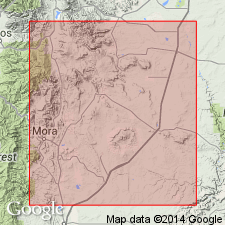
- Las Vegas-Raton basin
Summary:
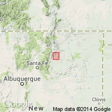
Named for Las Feveras Canyon [spelled Los Febres Canyon on map] which drains into northwestern part of Ocate Valley, Mora Co, NM, Las Vegas-Raton basin. [No type locality designated.] Is well exposed in sides of three small basalt-capped buttes west of road 2 mi north of Ocate. Traceable from Ocate Valley into Bonito Canyon, and may be present near Aurora and Ojo Feliz. Composed of brownish-red alluvium and gravel. Is more than 150 ft thick. Geologic map. Overlies Sangre de Cristo formation. Underlies basalt flow. May correlate with some part of Santa Fe Group. No fossils. Probably is a valley fill that accumulated in Ocate and adjoining valleys prior to late volcanic activity in area. Assigned a Tertiary or Quaternary age, and a late Tertiary and early Quaternary age. Geologic map.
Source: GNU records (USGS DDS-6; Denver GNULEX).
- Usage in publication:
-
- Las Feveras Formation*
- Modifications:
-
- Age modified
- AAPG geologic province:
-
- Las Vegas-Raton basin
Summary:
Age changed from late Tertiary or early Quaternary to late Pliocene to early Pleistocene. Infilling of the valley produced by blockage that occurred near the monoclinal flexure that marks the present stream outlet to the valley. The cause of the blockage is unknown; it could have been caused by damming by lava or by faulting prior to volcanism. Flows of the third period of volcanism--the 3.3 to 3.1 m.y. old flows on Charette Mesa--rest on the Las Feveras.
Source: GNU records (USGS DDS-6; Denver GNULEX).
For more information, please contact Nancy Stamm, Geologic Names Committee Secretary.
Asterisk (*) indicates published by U.S. Geological Survey authors.
"No current usage" (†) implies that a name has been abandoned or has fallen into disuse. Former usage and, if known, replacement name given in parentheses ( ).
Slash (/) indicates name conflicts with nomenclatural guidelines (CSN, 1933; ACSN, 1961, 1970; NACSN, 1983, 2005, 2021). May be explained within brackets ([ ]).