

- Usage in publication:
-
- Larimer sandstone
- Modifications:
-
- First used
- Dominant lithology:
-
- Sandstone
- AAPG geologic province:
-
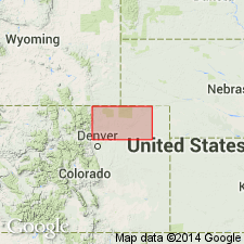
- Denver basin
Summary:
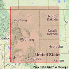
First published use for a sandstone, one of five unranked named sandstones in the Mesaverde formation. Is exposed in Larimer County canal in sec 24, T8N, R69W, Larimer Co, CO in the Denver basin. No type locality designated. Is 141 ft thick. Overlies unnamed shale of the Mesaverde. Underlies unnamed sandy shale of the Mesaverde. [No lithologic description given.] Cretaceous age.
Source: GNU records (USGS DDS-6; Denver GNULEX).
- Usage in publication:
-
- Larimer sandstone member*
- Modifications:
-
- Revised
- AAPG geologic province:
-
- Denver basin
Summary:
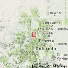
Recognized as one of five sandstones reassigned as a member of Pierre shale rather than as an unranked unit of the Mesaverde formation. Separated from the older Rocky Ridge sandstone member of Pierre by about 170 ft of "sandy beds," and from the younger Richard sandstone member of Pierre by 115 ft of beds. Is 78 ft thick in a measured section on Fossil Creek, south and southeast of Fort Collins. The basal sandstone is massive, has some concretions. The middle sandstone is a bench former. The upper sandstone is fossiliferous (ammonites), and forms the top of a hogback. Is usually less than 150 ft thick. Geologic map. Not separately mapped from the Pierre. Pierre forms extensive outcrops in Larimer, Morgan, and Washington Cos, CO in the Denver basin. Of Late Cretaceous age.
Source: GNU records (USGS DDS-6; Denver GNULEX).
- Usage in publication:
-
- Larimer Sandstone Member*
- Modifications:
-
- Overview
- AAPG geologic province:
-
- Denver basin
Summary:
Correlation of the Upper Cretaceous Pierre Shale (and its Hygiene, Terry, Rocky Ridge, and Larimer Sandstone Members) near Boulder, CO in Denver basin with the Pierre Shale (and its Sharon Springs, Kremmling, Muddy Buttes, Hygiene, Carter and Gunsight Pass Members) near Kremmling, CO, and with the upper part of the Mancos Shale (and its Morapos and Loyd Sandstone Members) and with the Iles Formation (and its Tow Creek and Trout Creek Sandstone Members) and Williams Fork Formation (and its Twentymile Sandstone Member); the last two are formations of the Mesaverde Group shown on fig. 2.
Source: GNU records (USGS DDS-6; Denver GNULEX).
- Usage in publication:
-
- Larimer Sandstone Member*
- Modifications:
-
- Areal extent
- AAPG geologic province:
-
- Denver basin
Summary:
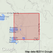
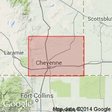
Geographically extended northward into WY along the Laramie Mountains. Replaces use of Parkman Sandstone Member in the Denver basin. Recognized at Francis Ranch on the outcrop in Ts14 and 15N, R69W, Laramie Co, WY and in the subsurface in Apache Co., 1 Polo Ranch in sec 14, T14N, R66W, Laramie Co, WY. Is a member of Pierre Shale 57 ft thick and is composed of orange, fine-grained, thickly bedded, fossiliferous (ammonite, gastropod) sandstone. Overlies and underlies unnamed shales of Pierre. Campanian age. Measured section.
Source: GNU records (USGS DDS-6; Denver GNULEX).
- Usage in publication:
-
- Larimer Sandstone Member*
- Modifications:
-
- Biostratigraphic dating
- AAPG geologic province:
-
- Denver basin
Summary:
Is a member of Pierre Shale in Laramie Co, WY and Larimer Co, CO in Denver basin. Collections of the ammonite genus RHAEBOCERAS from several localities in Larimer Co, CO indicate an early Maestrichtian (Late Cretaceous) age for Larimer. General stratigraphic position of RHAEBOCERAS includes the zones of BACULITES REESIDEI Elias and B. JENSENI Cobban.
Source: GNU records (USGS DDS-6; Denver GNULEX).
For more information, please contact Nancy Stamm, Geologic Names Committee Secretary.
Asterisk (*) indicates published by U.S. Geological Survey authors.
"No current usage" (†) implies that a name has been abandoned or has fallen into disuse. Former usage and, if known, replacement name given in parentheses ( ).
Slash (/) indicates name conflicts with nomenclatural guidelines (CSN, 1933; ACSN, 1961, 1970; NACSN, 1983, 2005, 2021). May be explained within brackets ([ ]).