The National Geologic Map Database is migrating to a new infrastructure. We apologize for any service disruptions during this process.
|
|---|


- Usage in publication:
-
- Lares limestone*
- Modifications:
-
- Revised
- Dominant lithology:
-
- Limestone
- AAPG geologic province:
-
- Caribbean region
Summary:
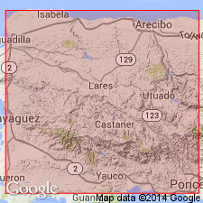
Aguadilla limestone shown on correlation chart as subdivision of Arecibo formation. Overlies Lares limestone, underlies Quebradillas limestone. Age is Oligocene. Maury (1919b) changed age to early Miocene.
Source: GNU records (USGS DDS-6; Reston GNULEX).
- Usage in publication:
-
- Lares limestone*
- Modifications:
-
- Revised
- AAPG geologic province:
-
- Caribbean region
Summary:
Sediments ranging from coarse bouldery gravel through sand, silt, clay, and marl to pure limestone, characterized by rapid lateral changes in lithology and intergrading both horizontally and vertically, are named the Rio Guatemala group. The San Sebastian formation represents the first interval of clastic deposition; the Lares limestone represents biohermal areas; and the Cibao marl with its Guajataca member represents the second interval of clastic deposition. Maximum thickness is 700 m. Unconformably overlies rocks of Late Cretaceous age; conformably underlies Aguada limestone. Age is Tertiary.
Source: GNU records (USGS DDS-6; Reston GNULEX).

- Usage in publication:
-
- Lares Limestone*
- Modifications:
-
- Overview
- AAPG geologic province:
-
- Caribbean region
Summary:
The Lares Limestone occurs on the north coast of Puerto Rico and consists of calcilutite, locally, and hard calcilutite interbedded with chalky limestone and calcareous clay. Maximum estimated thickness is 270 meters. The Lares is of late(?) Oligocene age.
Source: GNU records (USGS DDS-6; Reston GNULEX).
For more information, please contact Nancy Stamm, Geologic Names Committee Secretary.
Asterisk (*) indicates published by U.S. Geological Survey authors.
"No current usage" (†) implies that a name has been abandoned or has fallen into disuse. Former usage and, if known, replacement name given in parentheses ( ).
Slash (/) indicates name conflicts with nomenclatural guidelines (CSN, 1933; ACSN, 1961, 1970; NACSN, 1983, 2005, 2021). May be explained within brackets ([ ]).