The National Geologic Map Database is migrating to a new infrastructure. We apologize for any service disruptions during this process.
|
|---|


- Usage in publication:
-
- Laramie anorthosite complex
- Modifications:
-
- Overview
- AAPG geologic province:
-
- Southern Rocky Mountain region
Summary:
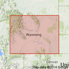
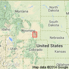
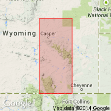
Used as an [informal?] term for the massive anorthosite of Precambrian age that lies north of the Precambrian Sherman Granite in the southern Laramie Mountains, WY in the Southern Rocky Mountain region. Two bodies of anorthosite mapped; they comprise the complex. The entire complex extends about 48 km north-south and 9 to 16 km east-west. Is about 7 m thick. The northern body is the larger. Several different types of anorthosite present--gabbroic anorthosite, olivine gabbroic anorthosite, quartz anorthosite, granulated anorthosite, and anorthosite --present within the body. Syenite (hypersthene and hornblende) on the western border are not included in the complex.
Source: GNU records (USGS DDS-6; Denver GNULEX).
- Usage in publication:
-
- Laramie Anorthosite
- Modifications:
-
- Overview
- AAPG geologic province:
-
- Southern Rocky Mountain region
Summary:
Term applied only to the anorthosite bodies. [No statement of designation as a formal or informal unit, or designation of type, etc.] Underlies the southern part of the Laramie Range, WY, Southern Rocky Mountain region. Occurs as a northern mass (the largest body), a southern mass, and several small marginal exposures. Extent of the masses is 30 miles north-south and 6-10 miles east-west, and they underlie 80+% of the area. Anorthositic rocks intruded by norite dikes. Hypersthene syenite intrudes the marginal areas on the west, northwest, and southeast. Hornblende syenite has intruded all the older rocks on the north margin. Granite intrudes all of the older rocks, and on the east has truncated the anorthosite. Three types of anorthosite mapped (geologic map) --anorthosite, granulated anorthosite, olive gabbroic anorthosite; norite and hypersthene syenite mapped. The Precambrian rocks in order of decreasing age are: older schists, anorthosite, gabbroic anorthosite, quartz anorthosite, granulated anorthosite, olivine gabbroic anorthosite, norite, hypersthene syenite, hornblende syenite, granite, and quartzofeldspathic dikes; only the anorthositic rocks are part of the Laramie.
Source: GNU records (USGS DDS-6; Denver GNULEX).
- Usage in publication:
-
- Laramie anorthosite
- Modifications:
-
- Overview
- AAPG geologic province:
-
- Southern Rocky Mountain region
Summary:
[Syenite and anorthosite described as separate, but associated units.] Laramie anorthosite [an informal? name] and related syenites of Precambrian age occupy the south-central part of the Laramie Range, WY in the Southern Rocky Mountain region. The anorthosite proper crops out over a length of about 50 km and an average width of 12 km. Is strongly sheared, dome shaped, elongate north-south. Is intruded by late stage hypersthene and hornblende syenite on north, northwest, and southeast. Sherman batholith truncates the anorthosite on the east side of Laramie Range indicating the anorthosite is older than the batholith. The anorthosite crosscuts the central metamorphic complex indicating the metamorphic rocks are older than the complex and the Sherman. On the geologic map, the hornblende syenite, hypersthene syenite, and anorthosite are separately mapped but name "Laramie anorthosite" not applied to any of the mapped units.
Source: GNU records (USGS DDS-6; Denver GNULEX).
- Usage in publication:
-
- Laramie anorthosite complex
- Modifications:
-
- Overview
- AAPG geologic province:
-
- Southern Rocky Mountain region
Summary:
Also called Laramie anorthosite. [Both usages probably intended to be informal.] Anorthosite comprises the bulk of the complex, but hypersthene syenite and hornblende syenite also included in it. Small norite bodies crop out within the hypersthene syenite. Sherman Granite intrudes the anorthosite. Older metamorphic rocks (amphibolite, biotite gneiss, quartzofeldspathic gneiss and minor amount of marble and quartzite) lie north of the complex. Mapped (geologic map) mostly in Albany Co., but extends into small area of Laramie and Platte Cos., WY, Southern Rocky Mountain region. Has [Middle Proterozoic] dates of 1.40 and 1.53 b.y.
Source: GNU records (USGS DDS-6; Denver GNULEX).
- Usage in publication:
-
- Laramie anorthosite-syenite complex
- Modifications:
-
- Geochronologic dating
- AAPG geologic province:
-
- Southern Rocky Mountain region
Summary:
[Treated as an informally named unit] present in the central part of the Laramie Range, WY, Southern Rocky Mountain region. Has a k/Ar age range of about 1.4 Ga (biotite) and about 1.51 Ga (hornblende). Underlain by Sherman Granite. Intruded the suture called the Mullen Creek-Nash Fork shear zone. The zone separates 2.5 Ga granitic gneisses on the north from the younger 1.7 Ga Sherman Granite to the south. Anorthosite and syenite of 1.42 Ga separately mapped (geologic map). but term "Laramie anorthosite-syenite-complex" not used on the map explanation. The sialic continental crust of the 2.5 Ga Wyoming province extends from the northern end of the Laramie Range to the northern contact of the anorthosite-syenite.
Source: GNU records (USGS DDS-6; Denver GNULEX).
- Usage in publication:
-
- Laramie Anorthosite*
- Modifications:
-
- Overview
- AAPG geologic province:
-
- Southern Rocky Mountain region
Summary:
Lead age of Sherman Granite and indistinguishable from that of the adjacent Laramie Anorthosite. Laramie shown on correlation chart as a unit of about same age as the Sherman Granite of WY and CO, and as the Silver Plume and St. Kevin Granites of CO. Shown as somewhat older than 1,400 m. y. Occurs in the Laramie Mountains of southeast WY in the Southern Rocky Mountain region.
Source: GNU records (USGS DDS-6; Denver GNULEX).
- Usage in publication:
-
- Laramie anorthosite
- Modifications:
-
- Overview
- AAPG geologic province:
-
- Southern Rocky Mountain region
GNU Staff, 1992, GNU Staff remark by M. E. Mac Lachlan. Anorthosite rocks of the Laramie Range, southern Wyoming.: U.S. Geological Survey Digital Data Series, DDS-6, 1 CD-ROM., release 3
Summary:
Several anorthosite bodies [not named] were mapped on the east side of the Laramie Mountains by Darton. Blackwelder, Siebenthal (1910, Geologic atlas of the United States, Laramie-Sherman, Wyoming, Folio No. 173). The entire anorthosite [not named] was mapped (geologic map) in the Laramie Mountains by K. F. Billings (1930, AJS, 5th series, v. 19, p.305-315, p.373-403). She stated: 1.) anorthosite of Precambrian age estimated to cover a 400 sq miles area about 36 miles long and 12 miles wide; 2.) some anorthosite occurs as outliers; 3.) the anorthosite is surrounded by Sherman Granite which crystallized later; 4.) some phases of the Sherman are syenitic; 5.) the anorthosite thought to be the basic differentiate of a magma whose acidic representative may be the Sherman batholith; 6.) the gneissoid arrangement of the anorthosite and gabbro, and the foliation in the schists surrounding or caught up in the anorthosite and granite indicated, the anorthosite moved as up a deep seated basic intrusive into the overlying rocks; 7.) age of anorthosite and gabbro not clear; 8.) the gabbro may be a differentiate of the anorthosite. In 1957, Newhouse, Hagner (USGS, MF 119) mapped two large anorthosite masses of Precambrian age [no place name attached to either mass]; the northern mass, the largest of the two, is situated in the center of T 17 N to northern part of T 21 N; the southern mass is 2 to 3 miles south of the northern one. Five types of anorthosite mapped --olivine anorthosite, noritic anorthosite, granulated anorthosite, quartzite anorthosite, and anorthosite (geologic map). Norite and syenite separately mapped.
Source: GNU records (USGS DDS-6; Denver GNULEX).
For more information, please contact Nancy Stamm, Geologic Names Committee Secretary.
Asterisk (*) indicates published by U.S. Geological Survey authors.
"No current usage" (†) implies that a name has been abandoned or has fallen into disuse. Former usage and, if known, replacement name given in parentheses ( ).
Slash (/) indicates name conflicts with nomenclatural guidelines (CSN, 1933; ACSN, 1961, 1970; NACSN, 1983, 2005, 2021). May be explained within brackets ([ ]).