The National Geologic Map Database is migrating to a new infrastructure. We apologize for any service disruptions during this process.
|
|---|


- Usage in publication:
-
- Lang Syne Member
- Modifications:
-
- Named
- Reference
- Dominant lithology:
-
- Sand
- Silt
- Clay
- AAPG geologic province:
-
- Atlantic Coast basin
Summary:
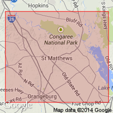
Formally named as member of Rhems Formation of Black Mingo Group. Used informally by Sloan (1908) as Lang Syne beds. Sloan (1908) and Cooke (1936) provided descriptions of outcrops at Tombs Field Gully on Lang Syne Plantation; it appears that those exposures were located east of Lang Syne Plantation and an unnamed cemetery. However, no geologic section closely matching Sloan's (1908) description could be located. Exposure described by Cooke (1936) is in what owner of Lang Syne Farms refers to as Tombs Field Gully (W. Peterkin, 1987, personal commun.); however, Cooke's description appears to be primarily of sediment above Rhems Formation within Congaree Formation. In an effort to resolve these inconsistencies, yet maintain term "Lang Syne", type section is chosen from Tombs Field Gully on Lang Syne Plantation. Reference section is designated along north side of County Rd 173 south of Little Beaver Creek at 33 degrees 44'26" north latitude and 80 degrees 54'16" west longitude. Consists of interbedded sands, silts, and clays (fuller's earth) and thin beds of silicified shell debris. Sand is very fine- to medium-grained, locally coarse-grained protoquartzite or orthoquartzite, red or yellow where highly weathered and white, gray, or black where freshly exposed. Silt is sandy, bioturbated, and gray-green where freshly exposed. Gray, opaline claystone, informally called Tavern Creek bed by Padgett (1980), is most characteristic lithology, although not at type section. Thickness of formation ranges from 30 to 60 ft. Unconformably overlain by Congaree Formation; underlain by Sawdust Landing Member (formally named) of the Rhems. [Text implies that Lang Syne is updip correlative of Perkins Bluff Member of Rhems.] Age is Paleocene. Report includes geologic sections.
Source: GNU records (USGS DDS-6; Reston GNULEX).
- Usage in publication:
-
- Lang Syne Formation
- Modifications:
-
- Revised
- Overview
- Areal extent
- Age modified
- Biostratigraphic dating
- AAPG geologic province:
-
- Atlantic Coast basin
Summary:
Lang Syne Member of Rhems Formation raised in rank to Lang Syne Formation of Black Mingo Group. Change in status justified by its distinct lithology and continuity in outcrop area. Base of the Lang Syne is marked in places by prominent layer of well-rounded pebbles. Poorly sorted, medium- to very coarse grained quartz sand with interspersed fine- to coarse-grained glauconitic grains commonly overlies the pebble bed. Above this basal meter or so, lower part of unit consists of thin-to thick-bedded, locally clayey, quartzose sands with sand-size glauconite grains. Upper part is composed of thin and laterally continuous beds of micaceous, medium-grained quartz sand interlayered with laminae or thin beds of black clay. Beds of black clay or fuller's earth occur locally near top of unit and in places compose the entire unit. Lang Syne Formation extends updip to Red Hill, Lee Co., to Fort Jackson, Richland Co., and into the valley of First Creek in Lexington Co. Unit is best exposed in western Sumter Co. along the Wateree River and in Calhoun Co. along the Congaree. Extends in the subsurface beyond the Aiken-Barnwell Co. line. Unit is 15 m thick in its type area near Fort Motte and reaches 20 m in western Sumter Co. Unconformably overlies the lower Paleocene Sawdust Landing Formation (rank raised) and unconformably underlies the middle Eocene Huber or Congaree Formations. Thanetian age of unit based on dinoflagellates, calcareous nannofossils, and mollusks. Correlates with the Williamsburg Formation and the Aquia Formation of VA.
Source: GNU records (USGS DDS-6; Reston GNULEX).
- Usage in publication:
-
- Lang Syne Formation
- Modifications:
-
- Overview
- AAPG geologic province:
-
- Atlantic Coast basin
Summary:
At the Savannah River Site, the Lang Syne appears to be the upper part of the "Ellenton Formation" of Siple (1967), the upper part of the "Black Mingo Formation" of Oldham (1981), and upper part of the "Rhems Formation" of McClelland (1987). Authors believe that term Ellenton should be abandoned, as it consists of two depositional sequences. Rhems is not used because palynological data indicate that the unit here is late Paleocene (Thanetian or Selandian), not early Paleocene, as the Rhems was dated by Van Nuiewenhuise and Colquhoun, 1982). In the study area, the Lang Syne consists of dark gray and black lignitic clays and poorly and moderately sorted, micaceous, lignitic, silty and clayey quartz sands and pebbly sands interbedded with dark gray clays. Basal unit is a greensand in places. Unit is about 80 ft thick near the southeastern boundary, but sporadic in the northwest. Overlies the Sawdust Landing Formation and underlies the Snapp Formation (new). [No Group assignment suggested.] Palynological assemblages indicate an assignment to NP 4-8 or 5-8. Probably correlates with the Naheola and Nanafalia formations of the Gulf Coastal Plain.
Source: GNU records (USGS DDS-6; Reston GNULEX).
- Usage in publication:
-
- Lang Syne Member
- Modifications:
-
- Revised
- AAPG geologic province:
-
- Atlantic Coast basin
GNU Staff, 1993, GNU Staff remark by E.D. Koozmin. Lang Syne Member.: U.S. Geological Survey Digital Data Series, DDS-6, 1 CD-ROM., release 3
Summary:
David Prowell (USGS, Branch of Eastern Regional Geology) believes that Lang Syne Member should be assigned to Williamsburg Formation, not Rhems Formation. He refers to Padgett (1980) for a perspective on this. There may be a forthcoming report or part of a report dealing with that part of the section and its revision. (Oral communication to Koozmin 2/93)
Source: GNU records (USGS DDS-6; Reston GNULEX).
For more information, please contact Nancy Stamm, Geologic Names Committee Secretary.
Asterisk (*) indicates published by U.S. Geological Survey authors.
"No current usage" (†) implies that a name has been abandoned or has fallen into disuse. Former usage and, if known, replacement name given in parentheses ( ).
Slash (/) indicates name conflicts with nomenclatural guidelines (CSN, 1933; ACSN, 1961, 1970; NACSN, 1983, 2005, 2021). May be explained within brackets ([ ]).