


- Usage in publication:
-
- Lane shales
- Modifications:
-
- Original reference
- Dominant lithology:
-
- Shale
- Sandstone
- AAPG geologic province:
-
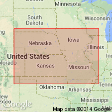
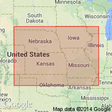
- Forest City basin
Summary:
Pg. 277, and pl. opp. p. 290; Amer. Jour. Sci., 3rd ser., v. 50, p. 460, and pl. opp. p. 466. Lane shales. Shales, with heavy sandstone at top and many sandstone beds scattered throughout, varying in thickness from thin to 150 feet. Underlain by Carlyle limestone and overlain by Garnett limestone. Age is Pennsylvanian.
Named from exposures at Lane, Franklin Co., eastern KS.
Source: US geologic names lexicon (USGS Bull. 896, p. 1144).
- Usage in publication:
-
- Lane shale
- Modifications:
-
- Revised
Summary:
Defined Lane shale as overlying Iola limestone and as separated from the higher Vilas shale by a limestone which they called Allen limestone (=Carlyle limestone), and stated that Garnett limestone of Haworth and Kirk included (ascending) Allen [Plattsburg] limestone, Vilas shale, and Stanton limestone. Thickness 30 to 150 feet. Age is Pennsylvanian (Pottawotomie).
Source: US geologic names lexicon (USGS Bull. 896, p. 1144); GNC KS-NE Pennsylvanian Corr. Chart, sheet 1, Oct. 1936.
- Usage in publication:
-
- Lane shale
- Modifications:
-
- Revised
Summary:
Lane shale (basal member of Lansing formation) overlies Iola limestone and underlies Plattsburg limestone, which is lower bed of "Garnett" limestone and is the limestone exposed at Carlyle, Kansas, according to Kansas Geol. Survey. Age is Late Pennsylvanian (Missouri age). [This definition of Lane shale was followed by Kansas Geol. Survey until 1931, when R.C. Moore (Kansas Geol. Soc. Gdbk., 5th Ann. Field Conf. correlation chart) restricted Lane shale to lower part of Lane shale of previous reports and defined it as separated from overlying Plattsburg limestone by (ascending) Argentine limestone, Island Creek shale, Farley limestone, and Bonner Springs shale.]
Source: US geologic names lexicon (USGS Bull. 896, p. 1144); GNC KS-NE Pennsylvanian Corr. Chart, sheet 1, Oct. 1936.
- Usage in publication:
-
- Lane shale
- Modifications:
-
- Revised
- AAPG geologic province:
-
- Forest City basin
Summary:
Pg. 18, 55-58. Lane shale of Kansas City group. Haworth applied Lane to 100 feet of sandy shale between 2 prominent limestones near town of Lane. The lower limestone was correctly identified by Haworth as Iola. The upper limestone, capping the scarp at Lane, is not Allen (Plattsburg limestone), as Haworth thought, but is a third limestone lying between the Iola and the Plattsburg. This limestone (Wyandotte of this report), although very prominent around Lane and northward to Kansas City and beyond, pinches out near Greeley in norotheastern Anderson County. It is clear the early workers recognized only 2 limestones immediately succeeding Lane shale, whereas there are 3 in northeastern Kansas. Age is Late Pennsylvanian (Missouri age).
Source: US geologic names lexicon (USGS Bull. 896, p. 1144); GNC KS-NE Pennsylvanian Corr. Chart, sheet 2, Oct. 1936.

- Usage in publication:
-
- Lane shale
- Modifications:
-
- Overview
Summary:
Lane shale of Kansas City group. In early 1932 (Jan. or Feb.) G.E. Condra, R.C. Moore, and C.O. Dunbar transferred Lane shale and their overlying Argentine limestone to Kansas City group. (See Nebraska Geol. Survey Bull., 2nd ser., no. 5, p. 17, table opp. p. 18.) Later in 1932 (Kansas Geol. Soc. Gdbk., 6th Ann. Field. Conf., Aug. 28 to Sept. 3) Moore still further restricted Lane shale by introducing two more named units (Frisbie limestone and Quindaro shale) between Argentine limestone and Lane shale, and stated that this restricted Lane shale was typical Lane shale. R.C. Moore and G.E. Condra adhered to this latter definition in their Oct. 1932 revised classification chart of Pennsylvanian rocks of Kansas and Nebraska.
Source: US geologic names lexicon (USGS Bull. 896, p. 1144); GNC KS-NE Pennsylvanian Corr. Chart, sheet 2, Oct. 1936.

- Usage in publication:
-
- Lane shale
- Lane-Bonner Springs shale (local)
- Modifications:
-
- Revised
Summary:
Pg. 117. Lane shale of Kansas City group. Lane shale overlies true Iola limestone at Lane type locality. Field studies have shown that limestone next above Lane shale at Lane is not †Allen (Plattsburg) limestone, but a lower formation that is absent in Allen County, [Kansas]. The base of Plattsburg limestone does not mark upper boundary of Lane shale, as inferred by serveral geologists. The limestone next above Lane shale is traced into limestone now called Argentine limestone. The Lane as thus defined is variable in lithology and thickness. In places, mostly where it is thin, i.e., 15 to 35 feet thick, it is wholly dark bluish-gray clayey shale. Where thick (50 to 110 feet) most of the shale is sandy and micaceous, light-gray to yellowish-brown or buff, with carbonaceous streaks but no coal beds. It is persistent from eastern part of Miami County, Kansas, to [the] northeast and north. Has been recognized in northern Missouri, Iowa, and in Platte Valley, Nebraska. Disappearance of Wyandotte limestone a short distance south of Lane makes it impossible to recognize upper boundary of Lane shale, and in that region Lane is combined with overlying shale under designation Lane-Bonner Springs shale. This combined unit (75 feet thick near Iola and 60+/- feet in southern Kansas) is dark bluish or bluish-gray clayey to fine silty shale. [On p. 45 Moore showed Lane shale of his "revised classification" as underlying Frisbie limestone, as overlying Raytown member of Iola limestone, and as included in Kansas City group.] Age is Late Pennsylvanian (Missouri age).
Source: US geologic names lexicon (USGS Bull. 896, p. 1144-1145); GNC KS-NE Pennsylvanian Corr. Chart, sheet 2, Oct. 1936.
- Usage in publication:
-
- Lane shale
- Modifications:
-
- Overview
Summary:
The USGS has not yet [ca. 1938] had occasion to consider, for its publications, the modified definitions of Lane shale and its transfer to Kansas City group.
Source: US geologic names lexicon (USGS Bull. 896, p. 1144-1145); GNC KS-NE Pennsylvanian Corr. Chart, sheet 2, Oct. 1936.
- Usage in publication:
-
- Lane shale
- Modifications:
-
- Revised
- AAPG geologic province:
-
- Forest City basin
Summary:
Pl. 1. Lane shale of Lansing group. Columnar section, Jackson and Cass Counties, northwestern Missouri, shows Lane shale in Lansing group. Includes (ascending) Island Creek shale, Farley limestone, and Bonner Springs members. Underlies Plattsburg limestone; overlies Iola limestone which includes (ascending) Frisbie limestone, Quindaro shale, and Argentine limestone members. Age is Late Pennsylvanian (Missourian).
Source: US geologic names lexicon (USGS Bull. 1200, p. 2099-2100).
- Usage in publication:
-
- Lane shale
- Modifications:
-
- Revised
Summary:
Pg. 2031 (fig. 4), 2032-2033; F.C. Greene and W.V. Searight, 1949, Missouri Geol. Survey Water Res. Rpt. Inv., no. 11, p. 13-14. Lane shale. In Kansas City group. Settlement of "Iola problem" has led to several changes in Missouri Survey's classification of middle and upper Kansas City beds so as to bring interstate agreement in nomenclature. Liberty Memorial shale (Clair, 1943), overlying Raytown limestone, is no longer considered uppermost member of Chanute shale but is suppressed as junior synonym of Lane shale. Frisbie limestone, Quindaro shale, and Argentine limestone, where were indicated as members of Iola limestone are classified with overlying Island Creek shale and Farley limestone as members of Wyandotte formation. Island Creek shale and Farley limestone, which were associated with overlying Bonner Springs shale as members of Lane shale, are included in Wyandotte formation. Bonner Springs shale is recognized as formational unit between Wyandotte and Plattsburg formations. Hence, Lane shale in Missouri is removed from Lansing group and placed in Kansas City group where it occupies interval between Iola limestone and Wyandotte limestone. Age is Late Pennsylvanian (Missourian).
Source: US geologic names lexicon (USGS Bull. 1200, p. 2099-2100).
- Usage in publication:
-
- Lane shale
- Modifications:
-
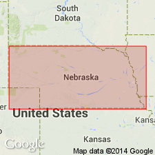
- Areal extent
- AAPG geologic province:
-
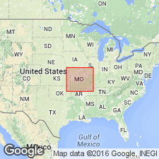
- Nemaha anticline
Summary:
Pg. 35. Lane shale of Kansas City group. Thickness of formation 14 feet in Sarpy County, Nebraska. Overlies Iola formation; underlies Frisbie limestone member of Wyandotte formation. Age is Late Pennsylvanian (Missourian).
Source: US geologic names lexicon (USGS Bull. 1200, p. 2099-2100).
- Usage in publication:
-
- Lane formation
- Modifications:
-
- Areal extent
- AAPG geologic province:
-
- Iowa shelf
- Forest City basin
Summary:
Pg. 418 (fig. 1), 420. Lane formation of Kansas City group. Thickness about 10.5 feet in Madison and Adair Counties, Iowa. Overlies Iola formation; underlies Frisbie limestone member of Wyandotte formation. Age is Late Pennsylvanian (Missourian).
Source: US geologic names lexicon (USGS Bull. 1200, p. 2099-2100).

- Usage in publication:
-
- Lane shale
- Modifications:
-
- Areal extent
- AAPG geologic province:
-
- Iowa shelf
- Forest City basin
Summary:
Pg. 25, fig. 5. Lane shale of Kansas City group. Recognized in Madison County as an olive to dark-gray fossiliferous shale containing limestone lenses; at some localities, has thin bed of maroon and green shale at base. In Union County, consists of greenish-gray to yellow calcareous shale with lenses of gray fossiliferous shale. Thickness 7 feet, Madison County; about 10 feet, Union County. Underlies Wyandotte limestone; overlies Iola limestone. Age is Late Pennsylvanian (Missourian).
Source: US geologic names lexicon (USGS Bull. 1200, p. 2099-2100).
For more information, please contact Nancy Stamm, Geologic Names Committee Secretary.
Asterisk (*) indicates published by U.S. Geological Survey authors.
"No current usage" (†) implies that a name has been abandoned or has fallen into disuse. Former usage and, if known, replacement name given in parentheses ( ).
Slash (/) indicates name conflicts with nomenclatural guidelines (CSN, 1933; ACSN, 1961, 1970; NACSN, 1983, 2005, 2021). May be explained within brackets ([ ]).