

- Usage in publication:
-
- Landslide Creek Formation*
- Modifications:
-
- Named
- Dominant lithology:
-
- Sandstone
- Mudstone
- Claystone
- Bentonite
- AAPG geologic province:
-
- Montana folded belt
Summary:
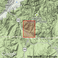
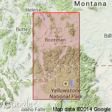
Named for exposures near Landslide Creek 2 mi west of Gardiner, Park Co, MT, Montana folded belt province. No type locality designated. A section 938 ft thick measured east of Landslide Creek in sec 21, T9S, R8E [but was not designated the type]. Sections also measured on Mount Everts and on Little Trail Creek. Geologic map. Cross sections. Composed of dark-gray, commonly conglomeratic sandstone interbedded with varicolored somber mudstone and claystone, and bentonite. The sandstone is lenticular, cross-bedded, feldspathic, chloritic, andesitic, and biotitic; cemented by clay, calcite, silica, chlorite, iron oxide, and zeolite; may be friable; has chert, andesite, and quartzite granules and pebbles. Brown beds rich in plant debris common near base. Few coal beds locally. All the fine-grained rocks are bentonitic and weather to a popcorn structure. Can be no less than 1,300 ft thick; may be as much as 2,300 ft thick. Found just north of Mount Everts, along mountain front nearly to Trail Creek, and northwest of Gardiner and east of Reese Creek, in addition to Landslide Creek area. Overlies Everts Formation (new) unconformably. Upper contact with Quaternary rocks. Of continental origin, mostly fluvial. Of Late Cretaceous age. Has scattered dinosaur bones and a Cretaceous pollen assemblage. Replaces use of Reese Formation (not used). Probably correlates with upper three formations of Livingston Group.
Source: GNU records (USGS DDS-6; Denver GNULEX).
- Usage in publication:
-
- Landslide Creek Formation*
- Modifications:
-
- Biostratigraphic dating
- AAPG geologic province:
-
- Montana folded belt
Summary:
Is a name used only near Gardiner, MT in the Montana folded belt province where it unconformably overlies the Everts Formation and is unconformably overlain by Tertiary volcanic rocks. Palynomorphs collected from the lower 150 ft yielded an assemblage from the PSEUDOPLICAPOLLIS NEWMANII Interval Zone, an indicator of the earliest Campanian. The upper part is undated. Correlation chart. Shown as equivalent to the lower part of the Cokedale Formation of the Livingston Group of the Livingston area and to the upper part of the Everts Formation and lower part of the Livingston Formation of the Madison Range.
Source: GNU records (USGS DDS-6; Denver GNULEX).
For more information, please contact Nancy Stamm, Geologic Names Committee Secretary.
Asterisk (*) indicates published by U.S. Geological Survey authors.
"No current usage" (†) implies that a name has been abandoned or has fallen into disuse. Former usage and, if known, replacement name given in parentheses ( ).
Slash (/) indicates name conflicts with nomenclatural guidelines (CSN, 1933; ACSN, 1961, 1970; NACSN, 1983, 2005, 2021). May be explained within brackets ([ ]).