- Usage in publication:
-
- Lands End Formation*
- Modifications:
-
- Named
- Dominant lithology:
-
- Till
- Soil
- Clay
- AAPG geologic province:
-
- Piceance basin
Summary:
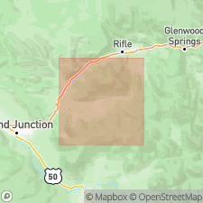
Named for Lands End quadrangle, Mesa Co, CO in the Piceance basin. Type section 5.5 ft thick measured in SW1/4 sec 4, T12S, R96W. Is a recessional moraine that includes brown to dark-brown unsorted pebbles in a gravelly clay overlain by soil horizon B, a dark-reddish-brown silt loam with a few rotten basalt pebbles and soil horizon A, a brownish-black structureless silt loam. Lower contact not exposed at type. Rests unconformably on Pliocene basalt at other localities. Is overlain by till of Grand Mesa Formation (new) one mile east of type. Includes till and terrace and fan gravels. Covers west end of Grand Mesa. Buried eastward by terminal and ground moraines of Grand Mesa Formation. Till is uniform; it is dominated by boulders, cobbles, and pebbles of basalt that crush easily between the fingers. Another section measured in SW1/4 NE1/4 sec 19, T10S, R95W. Is of Bull Lake?, Pleistocene age.
Source: GNU records (USGS DDS-6; Denver GNULEX).
For more information, please contact Nancy Stamm, Geologic Names Committee Secretary.
Asterisk (*) indicates published by U.S. Geological Survey authors.
"No current usage" (†) implies that a name has been abandoned or has fallen into disuse. Former usage and, if known, replacement name given in parentheses ( ).
Slash (/) indicates name conflicts with nomenclatural guidelines (CSN, 1933; ACSN, 1961, 1970; NACSN, 1983, 2005, 2021). May be explained within brackets ([ ]).

