

- Usage in publication:
-
- Lanai basalt
- Modifications:
-
- Named
- Dominant lithology:
-
- Basalt
- AAPG geologic province:
-
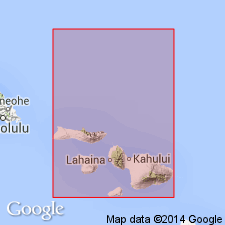
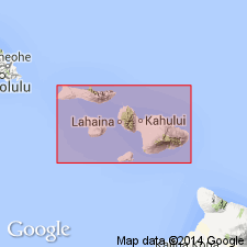
- Lanai
Wentworth, C.K., 1925, The geology of Lanai: Bernice P. Bishop Museum Bulletin, no. 24, 72 p.
Summary:
No type locality designated but well exposed in cliffs at SW and S sides of Island of Lanai [HI]. Series of lava flows constitute Island of Lanai. Highest elevation is 3,370 ft somewhat E of center. Base not exposed. Includes Manele Basalt [not named in accordance with Code], crater remnant, which forms headland S and W of Manele Harbor. Estimated age of Pleistocene(?) on basis of possible correlations with glaciations in North America and absence of wave-cut bench 35 ft above sea level.
Source: GNU records (USGS DDS-6; Menlo GNULEX).
- Usage in publication:
-
- Lanai volcanic series*
- Modifications:
-
- Age modified
- Revised
- AAPG geologic province:
-
- Lanai
Summary:
Name changed from Lanai basalt to Lanai volcanic series. Includes all volcanic rocks on Island of Lanai. Underlies with erosional unconformity lithified calcareous dunes, emerged marine limestone, and older alluvium of Pleistocene age. Map shows Pliocene age, but correlation table (p.23) gives Pliocene and older.
Source: GNU records (USGS DDS-6; Menlo GNULEX).

- Usage in publication:
-
- Lanai volcanic series*
- Modifications:
-
- Age modified
- AAPG geologic province:
-
- Lanai
Summary:
Lavas [of Lanai Volcanic Series] are covered with 10 to 20 ft of residual soil. Includes Lanai Basalt and Manele Basalt. Assigned Pliocene and Pleistocene(?) age on basis of degree of weathering and erosion.
Source: GNU records (USGS DDS-6; Menlo GNULEX).
- Usage in publication:
-
- Lanai Volcanic Series*
- Modifications:
-
- Geochronologic dating
- AAPG geologic province:
-
- Lanai
Summary:
K-Ar ages on basalt from six lava flows (Mahana, Kaluakapo and Manele shorelines [of Island of Lanai]) indicate mean age of 1.25 +/-0.04 Ma.
Source: GNU records (USGS DDS-6; Menlo GNULEX).
- Usage in publication:
-
- Lanai Basalt*
- Modifications:
-
- Geochronologic dating
- AAPG geologic province:
-
- Lanai
Summary:
K-Ar age on three samples from Maunalei Gulch [Island of Lanai] indicates mean of 0.81 +/-0.66 Ma.
Source: GNU records (USGS DDS-6; Menlo GNULEX).

- Usage in publication:
-
- Lanai Basalt*
- Modifications:
-
- Revised
- Reference
- AAPG geologic province:
-
- Lanai
Summary:
Name changed to Lanai Basalt. Formerly Lanai Volcanic Series of Stearns (1946). "Though there is a chance of confusion with the Lanai Basalt of Wentworth [1925] which consisted only of the lava flows, it would be more misleading to call the unit 'Lanai Volcanics' because it consists totally of shield-stage tholeiitic basalt." (p.66). Principal reference locality: Maunalei Gulch [20 deg 54' 15"N, 156 deg 53' 18"W, Lanai quad] on NE side of Island of Lanai (J.G. Moore, oral commun., 1986).
Source: GNU records (USGS DDS-6; Menlo GNULEX).
For more information, please contact Nancy Stamm, Geologic Names Committee Secretary.
Asterisk (*) indicates published by U.S. Geological Survey authors.
"No current usage" (†) implies that a name has been abandoned or has fallen into disuse. Former usage and, if known, replacement name given in parentheses ( ).
Slash (/) indicates name conflicts with nomenclatural guidelines (CSN, 1933; ACSN, 1961, 1970; NACSN, 1983, 2005, 2021). May be explained within brackets ([ ]).