

- Usage in publication:
-
- Lamar basalt
- Modifications:
-
- First used
- Dominant lithology:
-
- Basalt
- AAPG geologic province:
-
- Yellowstone province
Summary:
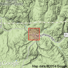
First used. Exposed in floor of Lamar valley for 8 mi above Soda Butte Creek, northern Yellowstone National Park, WY in the Yellowstone province. Intent to name not stated. No type locality designated. Forms a 2,000 ft scarp. Lower half is early basic breccias, and upper half is basalt topped by a thin veneer of rhyolite on the west side of Lamar River. Rhyolite rests on breccias on east side of Lamar River. [Not clear as to whether the Lamar basalt, the formation, includes the underlying breccia and/or the overlying rhyolite.] The basalt is uniform in thickness. Of Miocene-Pliocene age. Geologic map.
Source: GNU records (USGS DDS-6; Denver GNULEX).
For more information, please contact Nancy Stamm, Geologic Names Committee Secretary.
Asterisk (*) indicates published by U.S. Geological Survey authors.
"No current usage" (†) implies that a name has been abandoned or has fallen into disuse. Former usage and, if known, replacement name given in parentheses ( ).
Slash (/) indicates name conflicts with nomenclatural guidelines (CSN, 1933; ACSN, 1961, 1970; NACSN, 1983, 2005, 2021). May be explained within brackets ([ ]).