

- Usage in publication:
-
- Lake Shore trap*
- Modifications:
-
- Named
- Dominant lithology:
-
- Diabase
- Trap
- AAPG geologic province:
-
- Wisconsin arch
Summary:
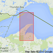
Name Lake Shore trap used to refer to diabase and diabase amygdaloid exposed at Keweenaw Point on Lake Superior. Includes one or more thin porphyry conglomerates. Underlies Outer conglomerate and overlies Great conglomerate. Thickness about 1,500 ft.
Source: GNU records (USGS DDS-6; Reston GNULEX).
- Usage in publication:
-
- Lake Shore trap
- Modifications:
-
- Overview
- Revised
- AAPG geologic province:
-
- Wisconsin arch
Summary:
Lake Shore trap is assigned as middle formation to Copper Harbor group. It ranges in thickness from 0 to 1800 ft and is composed of an upper trap sheet, a middle conglomerate, and a lower trap sheet. [In some reports, the lower trap and the middle conglomerate have been included in Great conglomerate.]
Source: GNU records (USGS DDS-6; Reston GNULEX).
- Usage in publication:
-
- Lake Shore Trap*
- Modifications:
-
- Not used
Summary:
Not used in Keweenawan Peninsula and adjacent areas of upper MI in Lake Superior region. Now replaced by unnamed mafic lava member of Copper Harbor Conglomerate. Cannot be correlated between Keweenaw Point and Porcupine Mountain and Black River areas; cannot be identified in westernmost MI or WI. Top should not be used to define base of upper Keweenawan because of great variation in stratigraphic position, pinch-outs or non-occurrence. Overlies Great Conglomerate (not used). Stratigraphic Chart. Is middle Precambrian in age.
Source: GNU records (USGS DDS-6; Denver GNULEX).
- Usage in publication:
-
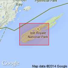
- Lake Shore Traps
- Modifications:
-
- Not used
Summary:
Follows nomenclature of White (1972). White (1972) uses unnamed lower mafic lava of Copper Harbor Conglomerate rather than Lake Shore. Study area is on Isle Royale on Keweenaw Peninsula, MI, Lake Superior region. [Though White (1972) did not specifically state that Lake Shore was being abandoned, not using name in its type area could be considered as abandonment. However, name Lake Shore has been used by subsequent workers.]
Source: GNU records (USGS DDS-6; Denver GNULEX).
- Usage in publication:
-
- Lake Shore Traps
- Modifications:
-
- Geochronologic dating
- AAPG geologic province:
-
- Lake Superior region
Summary:
U-Pb dates on three zircon fractions give an age of 1087.2 +/-1.6 Ma (68% probability of fit). Lake Shore is an andesite flow within Copper Harbor Conglomerate. Study area is on Keweenawan Peninsula, MI, Lake Superior region.
Source: GNU records (USGS DDS-6; Denver GNULEX).
- Usage in publication:
-
- Lake Shore traps
- Modifications:
-
- Overview
- Geochronologic dating
- AAPG geologic province:
-
- Wisconsin arch
Summary:
The middle portion of the Copper Harbor includes a succession of 31 lava flows with a maximum thickness of 600 m known as the Lake Shore traps. Composition of the Lake Shore ranges from Fe-rich olivine tholeiites at the base to Fe-rich olivine-bearing tholeiitic basaltic andesites to tholeiitic andesites at the top according to Paces and Bornhorst (1985). U-Pb age on zircon for the Lake Shore reported by Davis and Paces (1990) is 1094+/-3.6 Ma.
Source: GNU records (USGS DDS-6; Reston GNULEX).
For more information, please contact Nancy Stamm, Geologic Names Committee Secretary.
Asterisk (*) indicates published by U.S. Geological Survey authors.
"No current usage" (†) implies that a name has been abandoned or has fallen into disuse. Former usage and, if known, replacement name given in parentheses ( ).
Slash (/) indicates name conflicts with nomenclatural guidelines (CSN, 1933; ACSN, 1961, 1970; NACSN, 1983, 2005, 2021). May be explained within brackets ([ ]).