The National Geologic Map Database is migrating to a new infrastructure. We apologize for any service disruptions during this process.
|
|---|


- Usage in publication:
-
- Lake Flirt marl
- Modifications:
-
- Named
- Dominant lithology:
-
- Marl
- AAPG geologic province:
-
- South Florida province
Summary:
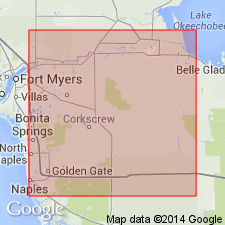
Lake Flirt marl, here named, overlies Coffee Mill Hammock shell marl. It is strikingly different, both in lithologic appearance and fossils, from Coffee Mill Hammock marl. Consists of a calcareous mud in which fresh-water shells, chiefly gastropods, are embedded. Has a thickness of 3 or 4 ft, and is best seen underlying the basin of Lake Flirt, from Old Fort Thompson to Coffee Mill Hammock, a distance of about 8 mi. This marl is of fresh-water origin and may be quite recent in age.
Source: GNU records (USGS DDS-6; Reston GNULEX).
- Usage in publication:
-
- Lake Flirt marl
- Modifications:
-
- Overview
- Areal extent
- AAPG geologic province:
-
- South Florida province
Summary:
Maximum thickness of Lake Flirt marl is about 8 ft along the Caloosahatchee River in old Lake Flirt bottom. It is doubtful whether use of name is justified outside of Caloosahatchee River area. In many places in upper Everglades, the fresh-water marl lies between the rock floor and overlying organic soils. Although marl is not the same everywhere, some being indurated, it has all been included in the Lake Flirt by Parker and Cooke, (1944).
Source: GNU records (USGS DDS-6; Reston GNULEX).

- Usage in publication:
-
- Lake Flirt Formation
- Modifications:
-
- Overview
- Areal extent
- AAPG geologic province:
-
- Florida platform
Summary:
Fresh-water sediments of the Lake Flirt Formation occur along the Caloosahatchee River east of Fort Thompson for about 19 km. Unit consists of thin beds of mucky dark sands and marly shell beds with abundant gastropods. Unconformably overlies the late Pleistocene Fort Thompson Formation of the Hialeah Group or older units. Age ranges from late Wisconsinan into the Holocene.
Source: GNU records (USGS DDS-6; Reston GNULEX).
For more information, please contact Nancy Stamm, Geologic Names Committee Secretary.
Asterisk (*) indicates published by U.S. Geological Survey authors.
"No current usage" (†) implies that a name has been abandoned or has fallen into disuse. Former usage and, if known, replacement name given in parentheses ( ).
Slash (/) indicates name conflicts with nomenclatural guidelines (CSN, 1933; ACSN, 1961, 1970; NACSN, 1983, 2005, 2021). May be explained within brackets ([ ]).