

- Usage in publication:
-
- Lake Edison Granodiorite*
- Modifications:
-
- Named
- Geochronologic dating
- Dominant lithology:
-
- Granodiorite
- AAPG geologic province:
-
- Sierra Nevada province
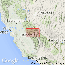
Summary:
Named for exposures at Lake Thomas A. Edison. Type locality along shores of upper end of Lake Thomas A. Edison [37 deg 22' 12"N, 118 deg 59' 11"W, Fresno Co, CA]. Is 4th youngest formally named unit of John Muir Intrusive Suite (new). Previously called granodiorite of Lake Edison (Lockwood and Lydon, 1975; Stern and others, 1981). Forms pluton more than 50 km long, narrow in middle, swelling at ends. Bulge at S end originally called Basin Mountain mass of Tungsten Hills Quartz Monzonite (Bateman, 1965). Consists of fine- to medium-grained equigranular hornblende-biotite granodiorite with abundant titanite. Intrudes Mount Givens and Lamarck Granodiorites and leucogranite of Graveyard Peak. Is intruded by Round Valley Peak Granodiorite and Mono Creek Granite (new). U-Pb age of 90 Ma (Stern and others, 1981) indicate Late Cretaceous age.
Source: GNU records (USGS DDS-6; Menlo GNULEX).
For more information, please contact Nancy Stamm, Geologic Names Committee Secretary.
Asterisk (*) indicates published by U.S. Geological Survey authors.
"No current usage" (†) implies that a name has been abandoned or has fallen into disuse. Former usage and, if known, replacement name given in parentheses ( ).
Slash (/) indicates name conflicts with nomenclatural guidelines (CSN, 1933; ACSN, 1961, 1970; NACSN, 1983, 2005, 2021). May be explained within brackets ([ ]).