The National Geologic Map Database is migrating to a new infrastructure. We apologize for any service disruptions during this process.
|
|---|


- Usage in publication:
-
- Lajas Formation*
- Modifications:
-
- Named
- Dominant lithology:
-
- Lava
- Tuff
- AAPG geologic province:
-
- Caribbean region
Summary:
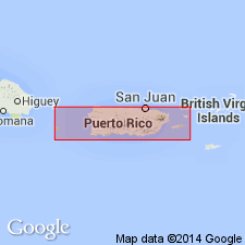
The Lajas Formation is here named in southwest Puerto Rico. It includes the lower part of the San German Formation below the Cotui Limestone Member, as defined by Mattson (1960). The San German Formation is here abandoned and the Cotui is raised to formation rank as the Cotui Limestone. The Lajas consists of grayish-red to grayish-purple porphyritic lava and tuff with labradorite and oxyhornblende phenocrysts in a fine-grained matrix of plagioclase, magnetite, hematite, and actinolite. The base of the Lajas is interlayered with lava flows characteristic of the Boqueron Basalt, which it overlies with minor disconformity. Underlies the Cotui Limestone with an apparently slight disconformity. Age is Late Cretaceous, probably middle Campanian or older, based on fossils in the overlying Cotui.
Source: GNU records (USGS DDS-6; Reston GNULEX).

- Usage in publication:
-
- Lajas Formation*
- Modifications:
-
- Overview
- AAPG geologic province:
-
- Caribbean region
Summary:
The Lajas Formation occurs in southwestern Puerto Rico and consists of massive, non-pillowed, grayish-purple, basalt flows. Minimum estimated thickness is 1000 meters. The Lajas is of Late Cretaceous age.
Source: GNU records (USGS DDS-6; Reston GNULEX).
For more information, please contact Nancy Stamm, Geologic Names Committee Secretary.
Asterisk (*) indicates published by U.S. Geological Survey authors.
"No current usage" (†) implies that a name has been abandoned or has fallen into disuse. Former usage and, if known, replacement name given in parentheses ( ).
Slash (/) indicates name conflicts with nomenclatural guidelines (CSN, 1933; ACSN, 1961, 1970; NACSN, 1983, 2005, 2021). May be explained within brackets ([ ]).