- Usage in publication:
-
- Laffingal Member*
- Modifications:
-
- Named
- Dominant lithology:
-
- Schist
- Phyllite
- AAPG geologic province:
-
- Appalachian basin
Summary:
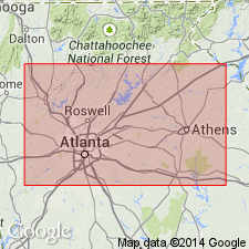
Named as a member of Nantahala Formation. Named for crossroads of Laffingal, Allatoona Dam 7.5-min quad, Bartow Co., northwestern GA. Consists of very dark-gray to black, graphitic to very graphitic phyllite/schist locally containing small garnets and commonly containing pyrite cubes. Contains lenses of blue-quartz and microcline granule, pebble, and locally cobble and boulder conglomerate identical to that of undivided Nantahala. Where not highly sheared, is interbedded or interlaminated with thin, fine-grained, iron-rich quartzose beds or laminae like those of Nantahala to the north and northeast. In most outcrops, Laffingal is sheared to button schist or buttony phyllite and quartzose laminae have been mobilized into folded quartz lenses or stringers. Directly overlies Corbin Metagranite in many places in Corbin massif; structurally both underlies and overlies pods of Corbin Metagranite in Mulberry Rock structure; structurally and probably stratigraphically underlies Bill Arp Formation. Age is Late Proterozoic to Middle Ordovician based on same reasoning for age of Nantahala Formation: must be younger than Middle(?) to Late Proterozoic Corbin Metagranite because Nantahala contains detritus from Corbin, and is probably older than Middle Ordovician Rockmart Slate because Nantahala is thrust upon Rockmart. Report includes geologic map and correlation chart.
Source: GNU records (USGS DDS-6; Reston GNULEX).
For more information, please contact Nancy Stamm, Geologic Names Committee Secretary.
Asterisk (*) indicates published by U.S. Geological Survey authors.
"No current usage" (†) implies that a name has been abandoned or has fallen into disuse. Former usage and, if known, replacement name given in parentheses ( ).
Slash (/) indicates name conflicts with nomenclatural guidelines (CSN, 1933; ACSN, 1961, 1970; NACSN, 1983, 2005, 2021). May be explained within brackets ([ ]).

