

- Usage in publication:
-
- Lafayette
- Modifications:
-
- Original reference
- AAPG geologic province:
-
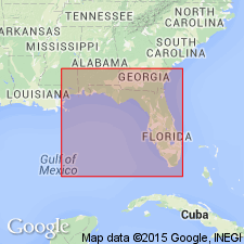
- Atlantic Coast basin
- Florida platform
- Gulf Coast basin
- Mid-Gulf Coast basin
- South Georgia sedimentary province
Hilgard, E.W., 1891, Orange sand, Lagrange, and Appomattox: American Geologist, v. 8, p. 129-131.
Summary:
Pg. 130. Lafayette (Quaternary) adopted by McGee, LeConte, Loughbridge, and Hilgard to replace Orange sand and Appomattox formation. Named from Lafayette County, Mississippi, where I first discriminated it from Eocene sands. Overlies Grand Gulf rocks.
Source: US geologic names lexicon (USGS Bull. 896, p. 1128-1129).
- Usage in publication:
-
- Lafayette formation
- Modifications:
-
- Principal reference
- Revised
- Dominant lithology:
-
- Loam
- Sand
- Gravel
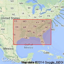
- AAPG geologic province:
-
- Atlantic Coast basin
- Florida platform
- Gulf Coast basin
- Mid-Gulf Coast basin
- South Georgia sedimentary province
Summary:
Published a treatise on Lafayette formation in which he defined it (p. 497) as a bed of loam, sand, and gravel, with several minor elements, notably kaolin or kaolinic clay, comminuted silica or siliceous clay, etc., in geographic distribution coinciding approximately with Coastal Plain of southeastern United States. Thickness a mere veneer to 200 feet or more about mouth of Mississippi. Separated from the newer Columbia formation by the strongest unconformity of Coastal Plain. In structural composition the formation is a unit, varying from place to place in local characters yet indivisible throughout its area of 250,000 sq mi, save on arbitrary grounds. Position in biotic scale unknown, its meager flora combining Laramie (Cretaceous) and Pleistocene or modern features, and its still more meager fauna representing the entire Neocene. It is a littoral deposit of materials carried into Atlantic Ocean and Gulf of Mexico [now called Gulf of America] by rivers still in existence when the land stood from 200 to 800 feet lower than today and when the waters of ocean and gulf extended 50 to 500 miles inland of present coast. The Lafayette formation as now defined was first discriminated in north Mississippi in 1855 and 1856 by Dr. E.W. Hilgard, and was named by him after Lafayette County, in which it is typically developed. It was then considered Quaternary (or Pleistocene). (Amer. Geol. 1891, v. 8, p. 130.) [On p. 502 McGee gave a table showing that Lafayette formation included deposits of Cretaceous (Tuscaloosa), Eocene (Orange sand of Safford, 1869, and Lagrange of Loughbridge), Neocene (Orange sand of Safford, 1888, and Appomattox of McGee), and Pleistocene ages (Lafayette of Hilgard, Orange sand of Hilgard (1860) and other writers, Columbia of McGee), etc.]
[Gulf of Mexico renamed Gulf of America (U.S. Board on Geographic Names per Presidential Executive Order 14172, issued January 20, 2025, and Department of Interior's Secretarial Order 3423, issued Feb. 7, 2025).]
Source: US geologic names lexicon (USGS Bull. 896, p. 1128-1129).
- Usage in publication:
-
- Lafayette formation
- Modifications:
-
- Overview
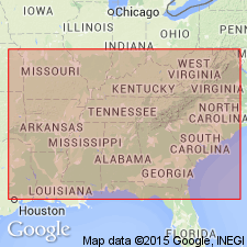
- AAPG geologic province:
-
- Atlantic Coast basin
- Florida platform
- Gulf Coast basin
- Mid-Gulf Coast basin
- South Georgia sedimentary province
Summary:
Lafayette formation may be either Tertiary or Quaternary. It is = "Orange sand," which is now dropped by agreement. It underlies, usually unconformably, Port Hudson (=Columbia of McGee) and unconformably overlies Grand Gulf beds.
Source: US geologic names lexicon (USGS Bull. 896, p. 1128-1129).

- Usage in publication:
-
- Lafayette formation†
- Modifications:
-
- Abandoned
- AAPG geologic province:
-
- Atlantic Coast basin
- Florida platform
- Gulf Coast basin
- Mid-Gulf Coast basin
- South Georgia sedimentary province
Summary:
In succeeding years [post Hilgard, 1892] the term Lafayette formation came to be generally applied throughout Atlantic and eastern Gulf Coastal Plains to the thin formation underlying Columbia group and assigned by most writers to late Pliocene, but considered by other writers to be early Pleistocene. The USGS early accepted the Tertiary age of this deposit, and in 1909 adopted Pliocene(?) as its specific age designation, based chiefly upon studies of T.W. Vaughan. As work in Southern States progressed the undesirability of retaining Lafayette formation became apparent to most workers, the name having been applied to different deposits in different areas, and E.W. Berry having shown that the typical deposits, in Lafayette County, Mississippi, belong to Wilcox group (Eocene). In 1915 the USGS abandoned Lafayette formation and adopted Citronelle formation (see G.C. Matson, 1916, USGS Prof. Paper 98-L and 98-M) for the nonmarine Pliocene deposits of Gulf Coastal Plain extending from western Florida into Texas and northward into Mississippi. The deposits formerly included in so-called Lafayette formation of New Jersey, Delaware, Pennsylvania, and Maryland are now [ca. 1936] divided into Brandywine formation (Pleistocene) and Bryn Mawr gravel (Pliocene?); in North Carolina and South Carolina they are now [ca. 1936] divided into Charlton formation (Pliocene?) and Citronelle formation (Pliocene).
Source: US geologic names lexicon (USGS Bull. 896, p. 1128-1129).
- Usage in publication:
-
- Lafayette gravel
- Modifications:
-
- [Reinstated]
- Areal extent
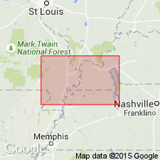
- AAPG geologic province:
-
- Illinois basin
- Mid-Gulf Coast basin
- Ozark uplift
- Upper Mississippi embayment
Summary:
Discussion of petrology and origin of Lafayette gravel and history and present status of term Lafayette. Lafayette gravel, as used in this study, refers to distinctive deposit found in Central Lowland, Interior Low Plateau, Ozark Plateau province, and Mississippi embayment part of Coastal Plain province. Consists primarily of insoluble components: chert, sandstone, quartz and quartzite pebbles, cobbles, and boulders associated with noncalcareous sands, silts, and clays, which in the aggregate are either stained or, less commonly, cemented by oxides of iron and manganese. Occurs as local blanket deposits in western Kentucky in area of 1,300 square miles as lenticular terrace and channel deposits, generally poorly exposed beneath glacial drift, and in glaciated regions. Thickness rarely exceeds 50 feet except in axial parts of lower Mississippi delta. In regions underlain by pre-Mesozoic rocks, Lafayette gravel commonly restricted either to higher terraces of more prominent streams, to abandoned channels of previous stream cycles, or to isolated exposures, which in Central Lowland province occupy positions on some of highest and oldest erosion surfaces. By contrast, in Coastal Plain province the gravel is considerably more extensive. Age is late Cenozoic.
[Majority of study area in western Kentucky, south of Ohio River and west of Cumberland River.]
Source: US geologic names lexicon (USGS Bull. 1200, p. 2070).
For more information, please contact Nancy Stamm, Geologic Names Committee Secretary.
Asterisk (*) indicates published by U.S. Geological Survey authors.
"No current usage" (†) implies that a name has been abandoned or has fallen into disuse. Former usage and, if known, replacement name given in parentheses ( ).
Slash (/) indicates name conflicts with nomenclatural guidelines (CSN, 1933; ACSN, 1961, 1970; NACSN, 1983, 2005, 2021). May be explained within brackets ([ ]).