The National Geologic Map Database is migrating to a new infrastructure. We apologize for any service disruptions during this process.
|
|---|


- Usage in publication:
-
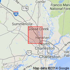
- Ladson formation*
- Modifications:
-
- Named
- Dominant lithology:
-
- Sand
- Clay
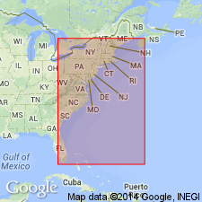
- AAPG geologic province:
-
- Atlantic Coast basin
Summary:
Ladson formation, here named near Charleston, SC, consists of sand and clay, coarse grained or conglomeratic at base. Divided into four members (ascending) characterized, respectively, by phosphate, fine sand, medium-grained sand, and coarse sand. Thickness at type section (drillhole) is 33.5 ft. Rests on eroded Tertiary deposits (Cooper marl). Pleistocene sequence in area is (ascending) Ladson sand on Tenmile Hill, Pamlico formation and terrace deposits along Goose Creek. Weathered parts of all units crop out in west bank of Poppenheim swamp west of Ladson. Outcrops in lower part of formation identified by Cooke (1936) as Talbot formation. Sloan (1908) had variously identified beds of Ladson with Lafayette phase, Hampton clays, Tenmile sands, and Accabee gravels--names no longer used. Age is Pleistocene.
Source: GNU records (USGS DDS-6; Reston GNULEX).
- Usage in publication:
-
- Ladson Formation
- Modifications:
-
- Overview
- AAPG geologic province:
-
- Atlantic Coast basin
Summary:
Ladson Formation interpreted as a fluvial/deltaic deposit. Equivalent to upper Talbot terrace of Colquhoun, 1974. Pre-Ten Mile Hill in age. Charleston-area equivalent of the Canepatch Formation according to J.C. Corrado et al (1986: SC Geol, v. 30, no. 1, p. 19-46)
Source: GNU records (USGS DDS-6; Reston GNULEX).
For more information, please contact Nancy Stamm, Geologic Names Committee Secretary.
Asterisk (*) indicates published by U.S. Geological Survey authors.
"No current usage" (†) implies that a name has been abandoned or has fallen into disuse. Former usage and, if known, replacement name given in parentheses ( ).
Slash (/) indicates name conflicts with nomenclatural guidelines (CSN, 1933; ACSN, 1961, 1970; NACSN, 1983, 2005, 2021). May be explained within brackets ([ ]).