

- Usage in publication:
-
- Lac La Croix Granite*
- Modifications:
-
- Named
- Dominant lithology:
-
- Granite
- AAPG geologic province:
-
- Lake Superior region
Summary:
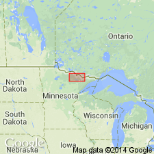
Named for distinctive, widespread, uniform light-pink biotite granite that crops out in type area south of Lac La Croix, in northern St. Louis Co, northwest MN in the Lake Superior region. Considered part of Vermilion Granitic Complex (new rank). Mapped separate from granite-rich migmatite or schist-rich migmatite where granitic rocks contain more than 5 percent of gneissic or schistose inclusions. Lac La Croix Granite and associated migmatitic rocks previously mapped as Vermilion Granite (now abandoned). Numerous exposures east of Echo Lake and south of Lac La Croix, where reference locality is designated in roadcuts accessible along Echo Trail, just south of Little Indian Sioux River (Shell Lake 7 1/2 min quad). Quartz-feldspar gneiss border facies is well exposed in a designated reference locality near mouth of Long Slough on Namakan Lake (Hale Bay 7 1/2 min quad). Geologic map. Contacts with associated migmatitic rocks are broadly gradational. Is Late Archean in age.
Source: GNU records (USGS DDS-6; Denver GNULEX).

- Usage in publication:
-
- Lac La Croix Granite*
- Modifications:
-
- Overview
- AAPG geologic province:
-
- Lake Superior region
Summary:
Is part of Vermilion Granitic Complex in the northern part of the Superior province of the Canadian Shield in northern MN in the Lake Superior region. Was passively emplaced into previously folded, stratified rocks at depths somewhat greater than plutonic activity in adjoining volcanic-plutonic belts. Correlation chart. Is Late Archean in age.
Source: GNU records (USGS DDS-6; Denver GNULEX).
For more information, please contact Nancy Stamm, Geologic Names Committee Secretary.
Asterisk (*) indicates published by U.S. Geological Survey authors.
"No current usage" (†) implies that a name has been abandoned or has fallen into disuse. Former usage and, if known, replacement name given in parentheses ( ).
Slash (/) indicates name conflicts with nomenclatural guidelines (CSN, 1933; ACSN, 1961, 1970; NACSN, 1983, 2005, 2021). May be explained within brackets ([ ]).