- Usage in publication:
-
- Labadie limestone
- Modifications:
-
- Original reference
- Dominant lithology:
-
- Limestone
- AAPG geologic province:
-
- Chautauqua platform
Summary:
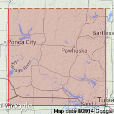
Labadie Limestone of Nelagoney Formation. Where best developed is a crystalline limestone of steel-gray color on fresh surface; on weathered surface upper part is brownish and lower part gray. Thickness 8 to 10 feet on the point south of Mission Creek in NE/4 sec. 36, T. 28 N., R. 10 E., but only 3 to 4 feet a mile north of that place. Thins so rapidly to north that it cannot be recognized north of E/4 of sec. 24 but a limestone 2 inches thick at about same horizon was seen at several places farther north in T. 28 and 29 N., R. 10 E. Lies 175+/- feet below middle bed of Oread Limestone and 65 feet above lower FUSILINA-bearing limestone. Contains some small, plump, rounded brachiopods. Age is upper [Late] Pennsylvanian. Report includes columnar sections, geologic maps.
Source: US geologic names lexicon, USGS Bull. 896.
For more information, please contact Nancy Stamm, Geologic Names Committee Secretary.
Asterisk (*) indicates published by U.S. Geological Survey authors.
"No current usage" (†) implies that a name has been abandoned or has fallen into disuse. Former usage and, if known, replacement name given in parentheses ( ).
Slash (/) indicates name conflicts with nomenclatural guidelines (CSN, 1933; ACSN, 1961, 1970; NACSN, 1983, 2005, 2021). May be explained within brackets ([ ]).

