- Usage in publication:
-
- La Sauses Member
- Modifications:
-
- Named
- Dominant lithology:
-
- Breccia
- Mudflow
- Lava
- Tuff
- AAPG geologic province:
-
- San Luis basin
Summary:
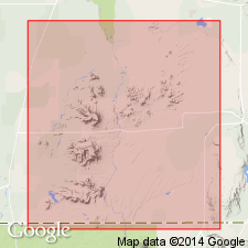
Named as middle (of 3) member (spelled La Sauses and Las Sauses) of Conejos Formation for exposures along entire length of Wildhorse cuesta east of La Sauses, Costilla Co, CO, San Luis basin. Forms cliffs. Exposures continue south to La Sauses Gorge and into Conejos Co. Makes up hills east of gorge; is locally in buried hills beneath unconformably overlying Manassa Member (new) of Conejos. No type locality given. Overlies Wildhorse Member (new) of Conejos unconformably. Thickness variable--50-800 ft--partly due to erosion of upper part before deposition of Manassa. Upper surface has relief of several hundred ft. Unconformities within member. Composed of fresh to highly oxidized, pink, brown, gray interbedded tuff-breccias, mudflows, lava flows, dense crystal tuffs, local epiclastic deposits east of Rio Grande. Crystal tuffs massive. Lava flows have well-developed flow structure. Vitrophyres up to 5 ft thick at base of some flows. Pumiceous tuffs interbedded with cross-bedded sediments of fluvial origin east of Wildhorse cuesta. Soft, light-colored crystal tuffs, tuff breccias, lava flows, dense crystal tuffs west of Rio Grande. Crudely stratified gray ash, tuff-breccias of pyroclastic origin on south side, South Pinon Hills. Soft homogeneous tan ash 200 ft thick along hills near Punche Valley. Petrographically rocks are glomeroporphyritic, augite-biotite-sanidine latite with felty groundmass. Geologic map. Oligocene age.
Source: GNU records (USGS DDS-6; Denver GNULEX).
For more information, please contact Nancy Stamm, Geologic Names Committee Secretary.
Asterisk (*) indicates published by U.S. Geological Survey authors.
"No current usage" (†) implies that a name has been abandoned or has fallen into disuse. Former usage and, if known, replacement name given in parentheses ( ).
Slash (/) indicates name conflicts with nomenclatural guidelines (CSN, 1933; ACSN, 1961, 1970; NACSN, 1983, 2005, 2021). May be explained within brackets ([ ]).

