The National Geologic Map Database is migrating to a new infrastructure. We apologize for any service disruptions during this process.
|
|---|


- Usage in publication:
-
- La Perla shale member
- Modifications:
-
- Original reference
- Dominant lithology:
-
- Shale
- AAPG geologic province:
-
- Gulf Coast basin
Summary:
Pg. 259 (fig. 2), 264. La Perla shale member of Yegua formation. Green and gray sandy bentonitic shale characterized by abundance of oyster beds. Thickness ranges from 50 to 150 feet. Basal member of formation. Overlies Falcon sandstone member (new) of Cook Mountain formation; underlies Mier sandstone tongue (new) of Yegua formation. Age is Eocene (Claiborne).
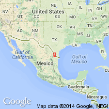
Named from La Perla ranch house [ranch no longer exists; formerly located on bank of Rio Grande, south of Dolores, approx. Lat. 27 deg. 09 min. 32 sec. N., Long. 99 deg. 25 min. 41 sec. W., in north part of San Ygnacio 7.5-min quadrangle, Zapata Co.], southern TX.
Source: US geologic names lexicon (USGS Bull. 1200, p. 2105).
For more information, please contact Nancy Stamm, Geologic Names Committee Secretary.
Asterisk (*) indicates published by U.S. Geological Survey authors.
"No current usage" (†) implies that a name has been abandoned or has fallen into disuse. Former usage and, if known, replacement name given in parentheses ( ).
Slash (/) indicates name conflicts with nomenclatural guidelines (CSN, 1933; ACSN, 1961, 1970; NACSN, 1983, 2005, 2021). May be explained within brackets ([ ]).