- Usage in publication:
-
- La Jencia Tuff
- Modifications:
-
- Named
- Dominant lithology:
-
- Tuff
- AAPG geologic province:
-
- Orogrande basin
Summary:
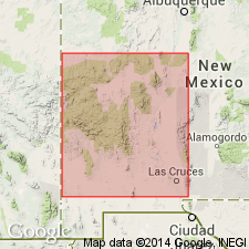
Named for La Jencia basin. Type section located in southern Bear Mountains, about 6.5 mi north of Magdalena and 1.8 mi southeast of Bear Springs on east slope of a west-dipping hogback, west side La Jencia basin in NW1/4 sec 22, T1S, R4W. Replaces names Potato Canyon Rhyolite Tuff (abandoned),A-L Peak Tuff (abandoned), and lower cooling unit of tuff of Bear Springs. Present throughout northeast Mogollon-Datil volcanic field. May be as thick as 3,000 ft with no exposed base. Is a multiple flow, crystal-poor, moderately to densely welded, one-feldspar ash-flow tuff. Has well developed primary flow structures. Most lineation directions are approximately east-west. Contains variable amount of small lithic fragments and large exotic blocks of sandstone, andesitic lava, and tuff. Usually contains 1-5 percent sanidine, minor quartz, and traces of biotite and magnetite. Usually contains lineated pumice. Overlies Hells Mesa Tuff. Underlies La Jara Peak Basaltic Andesite or Vicks Peak Tuff. Oligocene age assigned. Age based on stratigraphic position between two dated units. Erupted from Sawmill Canyon-Magdalena cauldrons which are interconnected.
Source: GNU records (USGS DDS-6; Denver GNULEX).

- Usage in publication:
-
- La Jencia Tuff
- Modifications:
-
- Geochronologic dating
- AAPG geologic province:
-
- Basin-and-Range province
Summary:
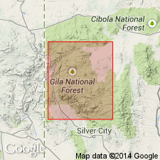
Has a 28.78 m.y. 40Ar/39Ar age [or Oligocene] in Mogollon-Datil volcanic field, Basin-and-Range province.
Source: GNU records (USGS DDS-6; Denver GNULEX).
For more information, please contact Nancy Stamm, Geologic Names Committee Secretary.
Asterisk (*) indicates published by U.S. Geological Survey authors.
"No current usage" (†) implies that a name has been abandoned or has fallen into disuse. Former usage and, if known, replacement name given in parentheses ( ).
Slash (/) indicates name conflicts with nomenclatural guidelines (CSN, 1933; ACSN, 1961, 1970; NACSN, 1983, 2005, 2021). May be explained within brackets ([ ]).

