The National Geologic Map Database is migrating to a new infrastructure. We apologize for any service disruptions during this process.
|
|---|


- Usage in publication:
-
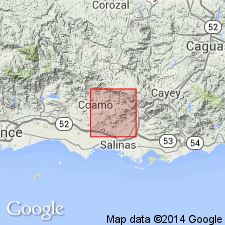
- La Guaba Lava Member*
- Modifications:
-
- Named
- Dominant lithology:
-
- Lava
Summary:
The Cariblanco Formation, here named, consists of thin- to medium-bedded siltstone and sandstone that intertongues with massive conglomerate. Units of limestone, tuff, and lava in the formation are named, in order of decreasing age, the La Guaba Lava Member, the Hacienda Larga Tuff Member, the Jobo Dulce Limestone Member, the Lio Juan Limestone Member, and the Sabana Hoyos Limestone Member. Overlies the Robles Formation; underlies the Coamo Formation. Age is Late Cretaceous. The La Guaba is fine-grained, dark-greenish-gray amygdaloidal, pillowed lava. Lies about 100 m above the base of the Cariblanco. Thickness ranges from 0 to 50 m.
Source: GNU records (USGS DDS-6; Reston GNULEX).
For more information, please contact Nancy Stamm, Geologic Names Committee Secretary.
Asterisk (*) indicates published by U.S. Geological Survey authors.
"No current usage" (†) implies that a name has been abandoned or has fallen into disuse. Former usage and, if known, replacement name given in parentheses ( ).
Slash (/) indicates name conflicts with nomenclatural guidelines (CSN, 1933; ACSN, 1961, 1970; NACSN, 1983, 2005, 2021). May be explained within brackets ([ ]).