


- Usage in publication:
-
- LaClede Bed*
- Modifications:
-
- Named
- Dominant lithology:
-
- Siltstone
- Sandstone
- Limestone
- AAPG geologic province:
-
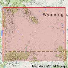
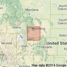
- Green River basin
Summary:
Named for LaClede stage station as lower bed (of three named beds) of Laney Member of Green River Formation in Sweetwater Co, WY in Washakie basin of Greater Green River basin at secs 14, 15, 23, T17N, R98W. Type section measured in secs 14, 15, and 23, T17N, R98W. Composed of at least 70 percent tan to dark-brown finely varved oil shale; other 30 percent is tan, tuffaceous siltstone and sandstone, minor tan oolite, algal limestone and ostracodal limestone. Laminae of gray coarsely crystalline analcime and gray acicular calcite common on west margin of basin. Is 320 ft thick at type where it overlies Cathedral Bluffs Tongue of Wasatch Formation and unconformably underlies Sand Butte Bed of Laney Member of Green River Formation. Is of Eocene age. Geologic map shows distribution in Washakie basin. [Bed extends south into adjacent CO.] Correlation chart; electric log.
Source: GNU records (USGS DDS-6; Denver GNULEX).
- Usage in publication:
-
- LaClede Bed*
- Modifications:
-
- Contact revised
- AAPG geologic province:
-
- Green River basin
Summary:
Lower contact of LaClede Bed of Laney Member of Green River Formation modified in that LaClede overlies the newly named Godiva Rim Member of Green River Formation. Is also laterally equivalent and grades into Godiva Rim. Weathers tan in contrast to the Godiva Rim (weathers gray). Of middle Eocene age. Cross section.
Source: GNU records (USGS DDS-6; Denver GNULEX).
- Usage in publication:
-
- LaClede Bed*
- Modifications:
-
- Overview
- AAPG geologic province:
-
- Green River basin
Summary:
Thirteen stratigraphic sections of LaClede Bed of Laney Member of Green River Formation are measured and correlated in Greater Green River basin. Sections begin in T18N, R97W, Sweetwater Co, WY (Washakie basin) and continue southwest for about 60 mi to vicinity of Vermillion Creek Canyon, T9N, R100W, Moffat Co, CO (Sand Wash basin). LaClede has maximum thickness of almost 800 ft in western part of Sand Wash basin; thins stratigraphically to northeast to less than 200 ft along northeastern part of Washakie basin. LaClede also thins across western and northwestern parts of Washakie basin due to erosion that occurred prior to deposition of overlying Sand Butte Bed of Laney. LaClede-Sand Butte erosion surface informally called Tower unconformity; erosion has removed as much as 450 ft of LaClede in a south to north direction along western margin of Washakie basin. Conformably overlies Cathedral Bluffs Tongue of Wasatch Formation; underlies Sand Butte, unconformably in Washakie basin (WY) sections and conformably in Sand Wash basin (CO) sections; conformably underlies Bridger Formation in southernmost Sand Wash basin section. LaClede contains numerous plant and animal fossils, most common are ostracodes. Age is middle Eocene based on stratigraphic position, fossil mammals and K-Ar age of 45.2 +/-1.7 m.y. assigned to tuff bed by O'Neill (1980, unpub. M.S. thesis, The Ohio State Univ.).
Source: GNU records (USGS DDS-6; Denver GNULEX).
- Usage in publication:
-
- LaClede Bed*
- Modifications:
-
- Areal extent
- Overview
- AAPG geologic province:
-
- Green River basin
Summary:
Isopach map (fig 29) shows areal extent within Greater Green River basin, WY and CO. LaClede (Laney Member of Green River Formation) was deposited in Lake Gosiute which was 160 mi long by 125 mi wide. At its maximum development, lake occupied more than 75 percent of basin. Depositional axis of lake basin was parallel to north flank of Uinta Mountains, and thickest deposits (800 ft) were near eastern end of mountains. Lake slowly retreated to southeast across basin and began to dry up; during its final stages it was restricted to southern Washakie and western Sand Wash basins. Toward end of deposition, Rock Springs anticline formed and as much as 400 ft of LaClede was eroded from crest and flanks of uplift. Unit represents longest period of sustained lacustrine deposition in Lake Gosiute (more than 2.5 m.y.). LaClede contains thickest oil-shale accumulation in Green River Formation; lower 350 ft contains at least 20 beds of oil shale that average 25 gallons of oil per ton of rock. Stratigraphic chart; cross sections. Eocene age.
Source: GNU records (USGS DDS-6; Denver GNULEX).

- Usage in publication:
-
- LaClede Bed*
- Modifications:
-
- Overview
Summary:
Paleogeographic map (fig. 76) of this bed of Laney Member of Green River Formation showing depositional environments in Greater Green River basin. Lower part, up to 350 ft thick, was deposited in saltwater and brackishwater; upper part, up to 450 ft thick, was deposited in freshwater. Change from saltwater to freshwater conditions was due to climate change from hot and arid to warm and humid in early middle Eocene. Freshwater lake covered area of 15,400 sq mi or 75% of floor of basin. Sediments deposited in deep, central part of lake formed oil shale and thin interbedded sandstone, siltstone, mudstone, shale, limestone, and tuff; silt and sand were deposited in nearshore and shoreline areas of lake; algal reefs (stromatolites) developed in some of shallow, near-shore waters. Flood-plain deposits of Bridger Formation surrounded lake and deposits of Battle Spring Formation formed along northeast part of basin. LaClede thins eastward by intertonguing with and gradual replacement by Godiva Rim Member of Green River. Intertongues with upper part of Wilkins Peak Member of Green River; underlies and intertongues with Sand Butte Bed of Laney. Generalized stratigraphic correlation chart (fig. 41). Eocene age.
Source: GNU records (USGS DDS-6; Denver GNULEX).
For more information, please contact Nancy Stamm, Geologic Names Committee Secretary.
Asterisk (*) indicates published by U.S. Geological Survey authors.
"No current usage" (†) implies that a name has been abandoned or has fallen into disuse. Former usage and, if known, replacement name given in parentheses ( ).
Slash (/) indicates name conflicts with nomenclatural guidelines (CSN, 1933; ACSN, 1961, 1970; NACSN, 1983, 2005, 2021). May be explained within brackets ([ ]).