

- Usage in publication:
-
- Kyrock conglomerate
- Modifications:
-
- Original reference
- Dominant lithology:
-
- Conglomerate
- Sandstone
- AAPG geologic province:
-
- Cincinnati arch
Summary:
Pg. 89; A.C. McFarlan, 1943, Geol. Kentucky, Lexington, KY, Kentucky Univ., p. 109. Kyrock conglomerate. Massive conglomeratic sandstone impregnated with asphalt. Equivalent to lower conglomerate of Caseyville and part of channel which connected Eastern Interior and Appalachian coal fields. Age is Pennsylvanian.
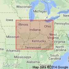
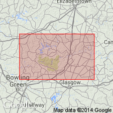
Exposed on Nolin River at Kyrock, Edmonson Co., central KY. Traced eastward into Hart, Green, Taylor and Larue Cos.
Source: US geologic names lexicon (USGS Bull. 1200, p. 2063).
- Usage in publication:
-
- Kyrock Sandstone Member
- Modifications:
-
- Revised
- AAPG geologic province:
-
- Cincinnati arch
- Illinois basin
Summary:
Unit referred to as Kyrock Sandstone Member of Caseyville Formation. Is paleovalley fill in Leithfield, Glen Dean, Hardinsburg, and Golconda formations. Underlies Main Nolan coal bed of Caseyville. Age is Early Pennsylvanian.
Source: GNU records (USGS DDS-6; Reston GNULEX).
For more information, please contact Nancy Stamm, Geologic Names Committee Secretary.
Asterisk (*) indicates published by U.S. Geological Survey authors.
"No current usage" (†) implies that a name has been abandoned or has fallen into disuse. Former usage and, if known, replacement name given in parentheses ( ).
Slash (/) indicates name conflicts with nomenclatural guidelines (CSN, 1933; ACSN, 1961, 1970; NACSN, 1983, 2005, 2021). May be explained within brackets ([ ]).