The National Geologic Map Database is migrating to a new infrastructure. We apologize for any service disruptions during this process.
|
|---|


- Usage in publication:
-
- Kurry Creek Member*
- Modifications:
-
- Named
- Dominant lithology:
-
- Conglomerate
- Sandstone
- Shale
- Limestone
- AAPG geologic province:
-
- Idaho Mountains province
Summary:
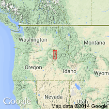
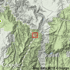
Named as a member in upper part of Doyle Creek Formation (new) of Seven Devils Group (rank raised). Replaces Pittsburg Formation, a name abandoned [reason for abandonment not explained]. A stratigraphic section measured in sec 23, T27N, R1W, Grave Point 7 1/2 min quad, Idaho Co, ID, Idaho Mountains province, designated the type section. Crops out only in Pittsburg Landing area. Conformably overlies Wild Sheep Formation (new) of Seven Devils Group. Is unconformably overlain by Coon Hollow Formation. Is 270 m thick at type. [Relationship to rest of Doyle Creek Formation not explained.] Composed of: 1) conglomerate that is poorly sorted, crudely graded, has some cross-laminae, and has clasts that range from angular to well rounded and are mostly volcanic flow, volcaniclastic, and plutonic rocks (metamorphosed quartz diorite, trondjhemite, and gabbro); 2) dark-brown sandstone that contains volcanic rock fragments, plagioclase, quartz, chlorite, calcite, feldspar, etc; 3) dark-brown shale that has wood fragments; and 4) argillaceous and carbonaceous limestone. Deposited in a marine environment near a landmass. Is Late Triassic (late Karnian to middle Norian) age. Ammonites and HALOBIA identified. Correlates with upper part of Clover Creek Greenstone. Geologic map. Stratigraphic column.
Source: GNU records (USGS DDS-6; Denver GNULEX).
- Usage in publication:
-
- Kurry Creek Member†
- Modifications:
-
- Abandoned
- AAPG geologic province:
-
- Blue Mountains province
- Snake River basin
Summary:
Unit abandoned. Rocks of its upper part are reassigned to overlying Coon Hollow Formation; strata of its lowermost part are reassigned to the UNDIVIDED Doyle Creek Formation.
Source: GNU records (USGS DDS-6; Menlo GNULEX).
For more information, please contact Nancy Stamm, Geologic Names Committee Secretary.
Asterisk (*) indicates published by U.S. Geological Survey authors.
"No current usage" (†) implies that a name has been abandoned or has fallen into disuse. Former usage and, if known, replacement name given in parentheses ( ).
Slash (/) indicates name conflicts with nomenclatural guidelines (CSN, 1933; ACSN, 1961, 1970; NACSN, 1983, 2005, 2021). May be explained within brackets ([ ]).