

- Usage in publication:
-
- Kumuiliahi Formation*
- Modifications:
-
- Named
- Dominant lithology:
-
- Basalt
- AAPG geologic province:
-
- Maui
Summary:
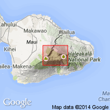
Type locality: rocks in lower part of wall of Haleakala north and northeast of Kumuiliahi Peak [20 deg 42' 16"N, 156 deg 12' 09"W, Kaupo 7.5' quad] Haleakala National Park, Island of Maui. Formerly assigned to Honomanu Volcanic Series by Stearns and Macdonald (1942). Here reassigned to Kumuiliahi Formation (new). Exposed in south wall of crater and in small knob at east edge of Koolau Gap. Composed of alkalic olivine basalt (thin-bedded pahoehoe and aa lava flows) with white phenocrysts of plagioclase feldspar up to 8 mm long and basaltic hawaiite. Lower contact not exposed; separated from overlying Kula Formation by angular unconformity. K-Ar ages are considered unreliable. Map shows Pleistocene age; text says "tentatively assigned Pleistocene age".
Source: GNU records (USGS DDS-6; Menlo GNULEX).
- Usage in publication:
-
- Kumuiliahi Formation*
- Modifications:
-
- Revised
- AAPG geologic province:
-
- Maui
Summary:
"In the lower part of the S wall of Haleakala Crater ... is a series of thin pahoehoe flows of basalt ... and the thin pahoehoe flows ... were thought probably to belong to the Honomanu series" (Stearns and Macdonald, 1942, p.72). "Later chemical studies show, however, that the basalt [Kumuiliahi Formation] is markedly alkalic, and it now appears probable that the lavas are a part of the Kula Series" (p.390-391).
Source: GNU records (USGS DDS-6; Menlo GNULEX).

- Usage in publication:
-
- Kumuiliahi Formation
- Modifications:
-
- Not used
- AAPG geologic province:
-
- Maui
Summary:
Rocks of Kumuiliahi Formation (Macdonald, 1978) appear more properly to belong to Kula (Macdonald and others, 1983, p.391) and here tentatively included in Kula Volcanics. Name "Kumuiliahi Formation" is not used.
Source: GNU records (USGS DDS-6; Menlo GNULEX).
For more information, please contact Nancy Stamm, Geologic Names Committee Secretary.
Asterisk (*) indicates published by U.S. Geological Survey authors.
"No current usage" (†) implies that a name has been abandoned or has fallen into disuse. Former usage and, if known, replacement name given in parentheses ( ).
Slash (/) indicates name conflicts with nomenclatural guidelines (CSN, 1933; ACSN, 1961, 1970; NACSN, 1983, 2005, 2021). May be explained within brackets ([ ]).