The National Geologic Map Database is migrating to a new infrastructure. We apologize for any service disruptions during this process.
|
|---|


- Usage in publication:
-
- Kulthieth formation*
- Modifications:
-
- Named
- Biostratigraphic dating
- Dominant lithology:
-
- Sandstone
- Siltstone
- Coal
- AAPG geologic province:
-
- Alaska Southern region
Summary:
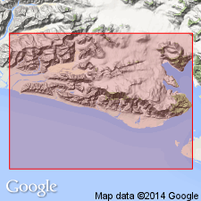
Named for exposures in area drained by Kulthieth, Kaliakh, and Duktoth Rivers, Type locality designated as measured section in vicinity of small lake at head of northeasternmost branch of Kulthieth River, Robinson Mountains, Yakataga district, southern AK. Consists of nonmarine and marine sandstone and siltstone with intercalated thin beds of high-rank coal. At type locality includes three predominantly sandy units which alternate with three predominantly silty units. Total thickness is at least 9300 ft. Base not seen. Apparently conformably underlies Poul Creek formation. Marine invertebrate fossils collected in upper part have been identified by H.E. Vokes as of late Eocene age. Age of Kulthieth formation given as Paleocene(?) and Eocene in map legend.
Source: GNU records (USGS DDS-6; Menlo GNULEX).
- Usage in publication:
-
- Kulthieth Formation*
- Modifications:
-
- Areal extent
- Age modified
- Biostratigraphic dating
- AAPG geologic province:
-
- Alaska Southern region
Summary:
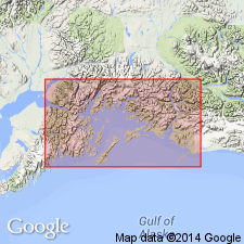
Kulthieth Formation geographically extended into Bering River area at expense of Kushtaka Formation (thereby abandoning Kushtaka Formation owing to more widespread extent of Kulthieth and equivalent age and lithology of these two units. Consists of interbedded arkosic sandstone, carbonaceous siltstone and shale, with minor coal. In Chugach National Forest overlies Stillwater Formation; underlies Tokun Formation. Age in Chugach National Forest is Eocene only based on fossil plants (Wolfe, 1977; Turner and others, in press) and mollusks (F.S. MacNeil IN Wolfe, 1977) and on stratigraphic relations with underlying and overlying formations. [Overall age remains Paleocene, Eocene, and Oligocene.]
Source: GNU records (USGS DDS-6; Menlo GNULEX).
- Usage in publication:
-
- Kulthieth Formation*
- Modifications:
-
- Age modified
- Biostratigraphic dating
- AAPG geologic province:
-
- Alaska Southern region
Summary:
Age of Kulthieth Formation is early Eocene to early Oligocene based on foraminifers, mollusks, and plant leaves. [Shown on correlation chart of central part of Yakutat terrane, fig.6, p.245].
Source: GNU records (USGS DDS-6; Menlo GNULEX).
- Usage in publication:
-
- Kulthieth Formation*
- Modifications:
-
- Age modified
- AAPG geologic province:
-
- Alaska Southern region
Summary:
Age of Kulthieth Formation is revised to Eocene on the basis of fossils.
Source: GNU records (USGS DDS-6; Menlo GNULEX).
For more information, please contact Nancy Stamm, Geologic Names Committee Secretary.
Asterisk (*) indicates published by U.S. Geological Survey authors.
"No current usage" (†) implies that a name has been abandoned or has fallen into disuse. Former usage and, if known, replacement name given in parentheses ( ).
Slash (/) indicates name conflicts with nomenclatural guidelines (CSN, 1933; ACSN, 1961, 1970; NACSN, 1983, 2005, 2021). May be explained within brackets ([ ]).