The National Geologic Map Database is migrating to a new infrastructure. We apologize for any service disruptions during this process.
|
|---|


- Usage in publication:
-
- Kuhiwa basaltic andesite*
- Modifications:
-
- Named
- Dominant lithology:
-
- Andesite
- AAPG geologic province:
-
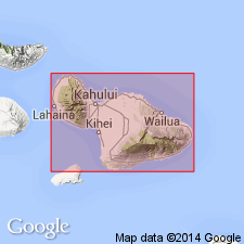
- Maui
Summary:
Named for exposures along Kuhiwa Gulch near hwy, Nahiku area, east Maui. Included as unit in Hana volcanic series. Occupies most of area east of Makapipi Stream. Appears to be single aa flow, locally nonporphyritic but usually with phenocrysts of brownish-green olivine up to 7.5 mm in diameter. Maximum thickness 75 ft in drillholes. Overlies with erosional unconformity Mossman basalt (new). Overlies stream gravel which in turn overlies Makapipi and Waiaaka lavas. Map shows middle(?) and late Pleistocene and Recent age.
Source: GNU records (USGS DDS-6; Menlo GNULEX).
- Usage in publication:
-
- Kuhiwa basaltic andesite*
- Modifications:
-
- Age modified
- AAPG geologic province:
-
- Maui
Summary:
Type locality: Kuhiwa Gulch near hwy [20 deg 48' 00"N, 156 deg 05' 08"W, Nahiku 7.5' quad] Nahiku area, northeast side of Island of Maui. Exposed over area 1.5 sq mi in Nahiku area. Assigned Pleistocene(?) age. [no basis given]
Source: GNU records (USGS DDS-6; Menlo GNULEX).

- Usage in publication:
-
- Kuhiwa Basaltic Andesite†
- Modifications:
-
- Abandoned
- AAPG geologic province:
-
- Maui
Summary:
Kuhiwa Basaltic Andesite of Stearns and Macdonald (1942) abandoned as formally named unit and called Kuhiwa flow, informal unit of Hana Volcanics. Hana Volcanics assigned Pleistocene(?) and Holocene age.
Source: GNU records (USGS DDS-6; Menlo GNULEX).
For more information, please contact Nancy Stamm, Geologic Names Committee Secretary.
Asterisk (*) indicates published by U.S. Geological Survey authors.
"No current usage" (†) implies that a name has been abandoned or has fallen into disuse. Former usage and, if known, replacement name given in parentheses ( ).
Slash (/) indicates name conflicts with nomenclatural guidelines (CSN, 1933; ACSN, 1961, 1970; NACSN, 1983, 2005, 2021). May be explained within brackets ([ ]).