- Usage in publication:
-
- Kugruk volcanics*
- Modifications:
-
- Named
- Dominant lithology:
-
- Basalt
- AAPG geologic province:
-
- Seward Peninsula province
- Alaska West-Central region
Summary:
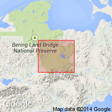
Named for Kugruk River, where type locality is designated as best exposures in cliffed east wall of canyon of river, 3 mi below Imuruk Lake, north-central Seward Peninsula, AK. Measured section described as (1) basal basaltic lava flow about 20 ft thick containing sparse olivine phenocrysts but free of inclusions and recognizable xenocrysts and (2) olivine-basalt lava flow, 40 ft thick containing large angular xenocrysts of orthoclase and lustrous opacite (chrom spinel?) and inclusions of granitic rock and dunite. Conformably underlies Imuruk volcanics (new). Base of cliff obscured by olivine-rich basalt flow of Gosling volcanics (new). Underlies gravel of upper member of Kougarok gravel (new) along Noxapaga River. Age is probably late Tertiary and may be in part of early Pleistocene(?) age based on stratigraphic relations.
Source: GNU records (USGS DDS-6; Menlo GNULEX).

- Usage in publication:
-
- Kugruk Volcanics†
- Modifications:
-
- Abandoned
- AAPG geologic province:
-
- Seward Peninsula province
- Alaska West-Central region
Summary:
Distinction between Kugruk Volcanics and overlying Imuruk Volcanics is invalid. Name Kugruk Volcanics is abandoned in favor of Imuruk for volcanic sequence. Age is late Tertiary to middle Pleistocene. A K-Ar determination of 5.7 +/-0.2 Ma was obtained from basalt from roof of Lava Camp mine.
Source: GNU records (USGS DDS-6; Menlo GNULEX).
For more information, please contact Nancy Stamm, Geologic Names Committee Secretary.
Asterisk (*) indicates published by U.S. Geological Survey authors.
"No current usage" (†) implies that a name has been abandoned or has fallen into disuse. Former usage and, if known, replacement name given in parentheses ( ).
Slash (/) indicates name conflicts with nomenclatural guidelines (CSN, 1933; ACSN, 1961, 1970; NACSN, 1983, 2005, 2021). May be explained within brackets ([ ]).

