

- Usage in publication:
-
- Kotsina conglomerate*
- Modifications:
-
- Named
- Dominant lithology:
-
- Conglomerate
- AAPG geologic province:
-
- Alaska Southern region
Summary:
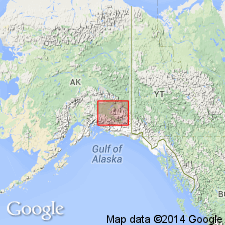
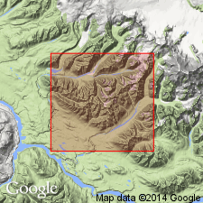
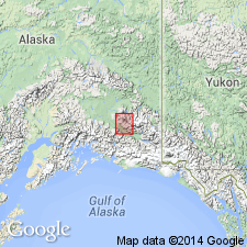
Occurs on Kotsina River, tributary to Chitina River, southern AK. Shown on geologic sketch map of Wrangell Mountains and adjacent area. Is massive bed of conglomerate dipping 20 to 30 deg southwestward and striking northwest and southeast. Overlies folded and contorted shale and slate that overlies volcanic greenstone. Overlain by rocks that are believed to be same as Kuskulana shales (new) of Triassic age.
Source: GNU records (USGS DDS-6; Menlo GNULEX).
- Usage in publication:
-
- Kotsina conglomerate*
- Modifications:
-
- Age modified
- AAPG geologic province:
-
- Alaska Southern region
Summary:
Occurs in curving belt that extends from Strelna Creek to and beyond Kotsina River. Shown on geologic map of Kotsina-Kuskulana district of Copper River region. Unconformably overlies Kuskulana formation, Chitistone limestone, or Nikolai greenstone. Overlain by unnamed sandstone, conglomerate and shale (of Late Jurassic age). Unconformably underlies Quaternary terrace gravel. Map legend shows age as Late Jurassic.
Source: GNU records (USGS DDS-6; Menlo GNULEX).
- Usage in publication:
-
- Kotsina Conglomerate*
- Modifications:
-
- Areal extent
- Age modified
- Geochronologic dating
- AAPG geologic province:
-
- Alaska Southern region
Summary:
Kotsina Conglomerate found on north side of Cheshnina River valley. Shown on geologic sketch map of southwestern Wrangell Mountains. Is probably at least 2000 to 2500 ft thick though upper contact not recognized. Unconformably overlies rocks as young as latest Triassic. K-Ar age on biotite from biotite granodiorite clast from the unit (in Valdez C-1 quad at 61 deg 44'00"N, 144 deg 02'50"W) yielded 157 +/-6 Ma. K-Ar age on hornblende from dike cutting Kotsina Conglomerate yielded 142 +/-5 Ma. Thus age is considered to be Middle or Late Jurassic.
Source: GNU records (USGS DDS-6; Menlo GNULEX).
For more information, please contact Nancy Stamm, Geologic Names Committee Secretary.
Asterisk (*) indicates published by U.S. Geological Survey authors.
"No current usage" (†) implies that a name has been abandoned or has fallen into disuse. Former usage and, if known, replacement name given in parentheses ( ).
Slash (/) indicates name conflicts with nomenclatural guidelines (CSN, 1933; ACSN, 1961, 1970; NACSN, 1983, 2005, 2021). May be explained within brackets ([ ]).