The National Geologic Map Database is migrating to a new infrastructure. We apologize for any service disruptions during this process.
|
|---|


- Usage in publication:
-
- Koolau basalt
- Modifications:
-
- First used
- AAPG geologic province:
-
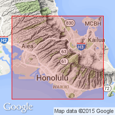
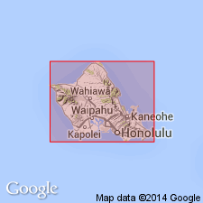
- Oahu
Summary:
Koolau Basalt is oldest formation on Oahu making up main mass of NE Oahu. Next youngest is complex calcareous reef formation.
Source: GNU records (USGS DDS-6; Menlo GNULEX).

- Usage in publication:
-
- Koolau volcanic series*
- Modifications:
-
- Named
- Dominant lithology:
-
- Basalt
- Tuff
- Breccia
- AAPG geologic province:
-
- Oahu
Summary:
Named for Koolau Range, Island of Oahu. [Formerly Koolau basalt of Wentworth, 1926]. Consists of basalt, beds of vitric and lithic tuff, dike complex, breccia, and intercalated soils making up Koolau Range. Basalt exceeds 3100 ft in thickness. Conformably overlies Kailua volcanic series. Unconformably overlaps Waianae volcanic series in Schofield Plateau area. Underlies with erosional unconformity Honolulu volcanic series.
Source: GNU records (USGS DDS-6; Menlo GNULEX).
- Usage in publication:
-
- Koolau volcanic series*
- Modifications:
-
- Mapped
- AAPG geologic province:
-
- Oahu
Summary:
Basalt flows, tuff beds, dikes, and breccia members separately mapped. Unconformably underlies Pleistocene consolidated sediments and Recent unconsolidated sediments in valleys and along beaches. Map shows Tertiary and early Pleistocene(?) age.
Source: GNU records (USGS DDS-6; Menlo GNULEX).
- Usage in publication:
-
- Koolau volcanic series*
- Modifications:
-
- Areal extent
- AAPG geologic province:
-
- Oahu
Summary:
Present interpretation is that Kailua lavas accumulated as flows in caldera of Koolau volcano. Now proposed to group these rocks with Koolau throat breccia and call them all caldera complex.
Source: GNU records (USGS DDS-6; Menlo GNULEX).
- Usage in publication:
-
- Koolau volcanic series*
- Modifications:
-
- Age modified
- AAPG geologic province:
-
- Oahu
Summary:
Stratigraphic chart gives Pliocene age but correlation chart (p.23) gives Pliocene and older age.
Source: GNU records (USGS DDS-6; Menlo GNULEX).
- Usage in publication:
-
- Koolau volcanic series*
- Modifications:
-
- Age modified
- AAPG geologic province:
-
- Oahu
Summary:
Figure map shows age to be Pliocene(?).
Source: GNU records (USGS DDS-6; Menlo GNULEX).

- Usage in publication:
-
- Koolau volcanic series*
- Modifications:
-
- Revised
- AAPG geologic province:
-
- Oahu
Summary:
Includes [improperly, since series cannot be part of series], Kailua volcanic series. Rocks of Koolau volcanic series, known variously as Koolau basalt [Wentworth, 1926], Koolau series [Wentworth and Winchell, 1947], and Koolau formation [Wentworth and Winchell, 1947]. Well exposed in Nuuanu Pali, great cliff on NE side of Koolau Range. Age assignment of Pliocene(?) based on degree of weathering and unconformable relationships to later Pleistocene rocks and shorelines.
Source: GNU records (USGS DDS-6; Menlo GNULEX).
- Usage in publication:
-
- Koolau volcanic series*
- Modifications:
-
- Geochronologic dating
- AAPG geologic province:
-
- Oahu
Summary:
K-Ar ages on samples of tholeiitic basalt of Koolau volcanic series (collected from roadcuts at Waimea Bay, adjacent to University of Hawaii and Kamehameha Hwy) indicate range of 2.56 to 2.14 Ma.
Source: GNU records (USGS DDS-6; Menlo GNULEX).
- Usage in publication:
-
- Koolau Volcanic Series*
- Modifications:
-
- Geochronologic dating
- AAPG geologic province:
-
- Oahu
Summary:
Koolau Volcanic Series form 2.3 Ma tholeiitic shield in SE part of Oahu. Shield, cut by vents of Honolulu Volcanic Series of late Pleistocene and Holocene age.
Source: GNU records (USGS DDS-6; Menlo GNULEX).
- Usage in publication:
-
- Koolau Volcanic Series*
- Modifications:
-
- Geochronologic dating
- Paleomagnetics
- AAPG geologic province:
-
- Oahu
Summary:
Subaerial Koolau Volcano formed entirely during early half of Matuyama Reversed Polarity Epoch. K-Ar ages ranged from 2.6 to 1.8 Ma.
Source: GNU records (USGS DDS-6; Menlo GNULEX).
- Usage in publication:
-
- Koolau Volcanics*
- Modifications:
-
- Revised
- AAPG geologic province:
-
- Oahu
Summary:
Koolau Volcanic Series (Stearns, IN Stearns and Vaksvik, 1935) reduced in rank and renamed Koolau Volcanics.
Source: GNU records (USGS DDS-6; Menlo GNULEX).
- Usage in publication:
-
- Koolau Formation
- Modifications:
-
- Revised
- AAPG geologic province:
-
- Oahu
Summary:
Koolau Volcanic Series (Stearns, IN Stearns and Vaksvik, 1935) reduced in rank and renamed Koolau Formation. "most volcanic series have been renamed formation" p.2
Source: GNU records (USGS DDS-6; Menlo GNULEX).

- Usage in publication:
-
- Koolau Basalt*
- Modifications:
-
- Redescribed
- Age modified
- AAPG geologic province:
-
- Oahu
Summary:
Koolau Volcanics of Lanphere and Dalrymple (1979) is here renamed Koolau Basalt to reflect its lithology of shield-stage tholeiitic basalt. Kailua Volcanic Series is here reduced in rank and renamed Kailua Member of Koolau Basalt. Principal reference locality of Koolau Basalt is Nuuanu Pali [21 deg 22' 13"N, 157 deg 47' 49"W, Honolulu 7.5' quad, Island of Oahu, HI] Assigned Pliocene age based on K-Ar ages ranging from 2.7 to 1.8 Ma (Doell and Dalrymple, 1973) However Pleistocene(?) age cannot be ruled out for youngest flows.
Source: GNU records (USGS DDS-6; Menlo GNULEX).
For more information, please contact Nancy Stamm, Geologic Names Committee Secretary.
Asterisk (*) indicates published by U.S. Geological Survey authors.
"No current usage" (†) implies that a name has been abandoned or has fallen into disuse. Former usage and, if known, replacement name given in parentheses ( ).
Slash (/) indicates name conflicts with nomenclatural guidelines (CSN, 1933; ACSN, 1961, 1970; NACSN, 1983, 2005, 2021). May be explained within brackets ([ ]).