The National Geologic Map Database is migrating to a new infrastructure. We apologize for any service disruptions during this process.
|
|---|


- Usage in publication:
-
- Konnarock Formation
- Modifications:
-
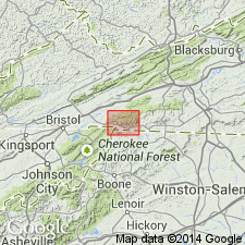
- Areal extent
- Overview
- AAPG geologic province:
-
- Piedmont-Blue Ridge province
Summary:
Konnarock Formation mapped in Washington, Smyth, and Grayson Cos. only. Thickness as much as 3275 ft. Diamictite most common toward top of the section. Overlies Mount Rogers Formation, also mapped only in these three counties. Age shown as Late Proterozoic.
Source: GNU records (USGS DDS-6; Reston GNULEX).
- Usage in publication:
-
- Konnarock Formation*
- Modifications:
-
- Named
- Dominant lithology:
-
- Diamict
- Arkose
- Sandstone
- Siltstone
- Mudstone
- Argillite
- AAPG geologic province:
-
- Appalachian basin
Summary:
Named for town of Konnarock, Konnarock 7.5-min quad, Washington Co., southwestern VA. Previously mapped as upper part of Mount Rogers Formation, but designated as a formation because of its glacial origin (in contrast with the mostly volcanic Mount Rogers Formation). Typically exposed along Whitetop Laurel Creek and adjacent roadcuts and (abandoned) railroad cuts from northwest of end of County Rd 728 at Creek Junction and Konnarock. Occurs in southwestern VA and eastern TN. Consists of mostly maroon, massive and bedded diamictite, rhythmite (graded sets of siltstone, sandstone, and mudstone), rhythmite with dropstones (laminated pebbly mudstone), massive argillite, arkose, and minor conglomerate. Rocks are gray or greenish gray at base of graded sets in rhythmites; arkose is pink or greenish gray. Unit is about 1 km thick. Konnarock is structurally isolated from Mount Rogers Formation. Lower contact with Mount Rogers is locally unconformable; upper contact with Lower Cambrian Unicoi Formation is knife sharp and best exposed on US Hwy 58 on Big Hill, about 1.5 km due south of Konnarock (outcrop now weathered, but was fresh at time of mapping). Age is Late Proterozoic based on 1) Early Cambrian (Tommotian?) marine trace fossil RUSOPHYCUS in upper part of Unicoi Formation, about 400 m stratigraphically above Konnarock Formation; 2) sharp contact between Konnarock and Unicoi indicating significant time gap; and 3) age of Mount Rogers is 760 Ma. Age constraints allow for Konnarock to have been deposited during a global episode of glaciation occurring between 700 and 650 Ma (Miller, 1989). Report includes geologic map.
Source: GNU records (USGS DDS-6; Reston GNULEX).
For more information, please contact Nancy Stamm, Geologic Names Committee Secretary.
Asterisk (*) indicates published by U.S. Geological Survey authors.
"No current usage" (†) implies that a name has been abandoned or has fallen into disuse. Former usage and, if known, replacement name given in parentheses ( ).
Slash (/) indicates name conflicts with nomenclatural guidelines (CSN, 1933; ACSN, 1961, 1970; NACSN, 1983, 2005, 2021). May be explained within brackets ([ ]).