- Usage in publication:
-
- Konawa formation
- Modifications:
-
- Named
- Dominant lithology:
-
- Redbeds
- Shale
- Sandstone
- Conglomerate
- AAPG geologic province:
-
- Chautauqua platform
- Arkoma basin
Summary:
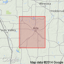
Named after town of Konawa, which is located on extreme eastern edge of outcrop, Seminole Co, OK, Chautauqua platform, as uppermost of three formations of Pontotoc terrane [Group] (new). No type locality designated. Is exposed over more than 100 sq mi in northwest part of Stonewall quad, in Seminole, Pottawatomie, and Pontotoc Cos, OK, Chautauqua platform and Arkoma basin. Overlies Stratford formation of Pontotoc (new); underlies Asher formation (new). Lower contact only roughly established--base is drawn at base of typical red beds of the area. Largely composed of typical red beds such as cover a large part of western OK. Red shales constitute the greatest thickness in the formation, but coarse red sandstones are often prominent and sometimes outcrop over large areas. No limestones were observed. About 500 ft thick. On Konawa road, 3 mi east of Asher, is an outcrop of heavy chert conglomerate that resembles beds of the same type contained by formations below Ada formation (new)--however, this conglomerate is arkosic, and lower strata are not. A series of coarse, red and brownish-red sandstones, 30 ft thick, caps north bluff of Canadian River at bridge south of Asher. These beds not observed to south. Northward, sandstones form a prominent eastward-facing escarpment. Upward-diminishing arkosic material disappears near base of these sandstones; this is formation top. Is Early Permian in age. Geologic map.
Source: GNU records (USGS DDS-6; Denver GNULEX).
For more information, please contact Nancy Stamm, Geologic Names Committee Secretary.
Asterisk (*) indicates published by U.S. Geological Survey authors.
"No current usage" (†) implies that a name has been abandoned or has fallen into disuse. Former usage and, if known, replacement name given in parentheses ( ).
Slash (/) indicates name conflicts with nomenclatural guidelines (CSN, 1933; ACSN, 1961, 1970; NACSN, 1983, 2005, 2021). May be explained within brackets ([ ]).

