The National Geologic Map Database is migrating to a new infrastructure. We apologize for any service disruptions during this process.
|
|---|


- Usage in publication:
-
- Kolob Limestone Member
- Modifications:
-
- Named
- Dominant lithology:
-
- Limestone
- AAPG geologic province:
-
- Plateau sedimentary province
Summary:
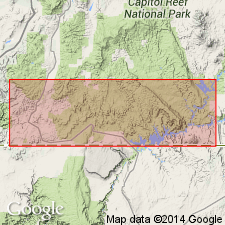
Named as a member of Carmel Formation of San Rafael Group for Kolob Terrace, Plateau sedimentary province. Type section exposed between Virgin River bridge and a point 2 mi west of Mount Carmel village, Kane Co. Extends as a wedge beneath Thousand Pockets Tongue of Navajo. Is resistant to erosion, caps mesas. Thickens westward from 122 ft at Skutumpah Ranch, 550 ft thick on Kolob Terrace to 833 ft (measured section) in T39S, R10W. Divisible into a basal limestone, middle silty and sandy unit, and an upper limestone. The upper limestone may be equivalent to Homestake Limestone Member and to lower part, Twin Creek Limestone. Fossil mollusks. Dated as Bajocian. Cross section. Block diagrams. Measured sections. Is 235 ft thick at head of Parunuweap Canyon where it unconformably overlies Temple Cap Member of Navajo Sandstone and underlies the newly named Crystal Creek Member of Entrada Sandstone, and where it consists of buff, cliff-forming, cherty to sandy limestone, red, purple, buff shale, and green, white gray sandstone. Was formerly an unnamed part of Carmel.
Source: GNU records (USGS DDS-6; Denver GNULEX).
- Usage in publication:
-
- Kolob Limestone Member
- Modifications:
-
- Not used
Summary:
Is not used in this report in Kane Co, UT (Plateau sedimentary province). Kolob Limestone Member of Thompson and Stokes (1970) is renamed the Co-op Creek Limestone Member at the base of the Carmel Formation. [Intent to abandon Kolob Limestone Member is not stated.] "It would be quite simple to accept the term Kolob Limestone Member as proposed by Thompson and Stokes (1970, p. 6) except that the name 'Kolob' was previously proposed for an igneous unit (Kolob Latite) in Iron County by Averitt (1962, p. 30). Therefore it is herein proposed that the limestone member be known as the Co-op Creek Limestone Member" (p. 57).
Source: GNU records (USGS DDS-6; Denver GNULEX).
For more information, please contact Nancy Stamm, Geologic Names Committee Secretary.
Asterisk (*) indicates published by U.S. Geological Survey authors.
"No current usage" (†) implies that a name has been abandoned or has fallen into disuse. Former usage and, if known, replacement name given in parentheses ( ).
Slash (/) indicates name conflicts with nomenclatural guidelines (CSN, 1933; ACSN, 1961, 1970; NACSN, 1983, 2005, 2021). May be explained within brackets ([ ]).