The National Geologic Map Database is migrating to a new infrastructure. We apologize for any service disruptions during this process.
|
|---|


- Usage in publication:
-
- Kokomo limestone
- Modifications:
-
- Named
- Dominant lithology:
-
- Limestone
- AAPG geologic province:
-
- Cincinnati arch
Summary:
Name Kokomo limestone applied to formation that in previous IN reports has been called "Waterlime." Named for town of Kokomo in Howard Co. Thickness 65 to 150 ft. Fossils suggest equivalence to Bertie or Lower Waterlime bed in lower part of Cayugan. [In 1909 (Cincinnati Society of Natural History Journal, v. 21), Foerste suggested that the brachiopod horizon at Kokomo should probably be distinguished from underlying eurypterid horizon by a distinct name, and Kokomo limestone be restricted to eurypterid beds, but no name was proposed and Kokomo limestone continued to be used as originally defined until 1927, when it was revised by Cumings and Shrock.]
Source: GNU records (USGS DDS-6; Reston GNULEX).
- Usage in publication:
-
- Kokomo limestone
- Modifications:
-
- Revised
- Overview
- AAPG geologic province:
-
- Cincinnati arch
Summary:
Kokomo limestone of Foerste (1904), which is probably of Cayugan age, consists of 60 ft of finely laminated impure limestone more argillaceous in lower part and more calcareous in upper part. Alternating beds of early material and purer limestone are characteristic. Rests unconformably on Mississinewa shale and is overlain, possibly unconformably, by Kenneth limestone.
Source: GNU records (USGS DDS-6; Reston GNULEX).
- Usage in publication:
-
- Kokomo limestone
- Modifications:
-
- Overview
- AAPG geologic province:
-
- Cincinnati arch
Summary:
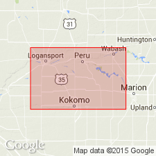
In 1927, writers restricted name Kokomo limestone to the thinly laminated limestone lying between Mississinewa shale below and a cherty limestone above, containing the brachiopod horizon as exposed in Markland Ave. quarry at Kokomo. The brachiopod horizon was included in overlying formation called Kenneth limestone. As now defined Kokomo limestone includes 45 to 50 ft of finely laminated argillaceous limestone unconformably overlying Mississinewa shale and disconformably underlying cherty Kenneth limestone in Markland Ave. quarry at Kokomo, and the 45 to 50 ft of similar stone lying below the cherty Kenneth limestone in Big Blue Hole and Kenneth quarries west of Logansport. Varies in thickness from a few ft to 60 ft. Fossils considered of Cayugan age and equivalent to those in the Bertie of NY.
Source: GNU records (USGS DDS-6; Reston GNULEX).

- Usage in publication:
-
- Kokomo limestone
- Modifications:
-
- Overview
- AAPG geologic province:
-
- Cincinnati arch
Summary:
Kokomo limestone is described as gray to brown banded dolomitic limestone, much of which is finely laminated. Although usually described as argillaceous, analyses show little alumina. At Kokomo and near Peru, upper beds are contorted, faulted, and recemented. Unconformably overlies Liston Creek, Mississinewa, and Niagaran reefs. Underlies Kenneth limestone or Middle Devonian limestone. Has been considered Cayugan, but upper part may be Devonian.
Source: GNU records (USGS DDS-6; Reston GNULEX).
- Usage in publication:
-
- Kokomo Limestone Member
- Modifications:
-
- Revised
- AAPG geologic province:
-
- Cincinnati arch
Summary:
Kokomo Limestone reduced in rank to Kokomo Limestone Member of Salina Formation. Age is Silurian.
Source: GNU records (USGS DDS-6; Reston GNULEX).
- Usage in publication:
-
- Kokomo Limestone Member
- Modifications:
-
- Revised
- AAPG geologic province:
-
- Cincinnati arch
Summary:
Kokomo Limestone Member assigned to Wabash Formation of Salina Group. Overlies Mississinewa Shale Member and underlies Kenneth Limestone Member. Age is Late Silurian.
Source: GNU records (USGS DDS-6; Reston GNULEX).

- Usage in publication:
-
- Kokomo Limestone Member
- Modifications:
-
- Overview
- AAPG geologic province:
-
- Cincinnati arch
Summary:
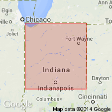
The Kokomo Limestone Member of the Wabash Formation of the Salina Group characteristically consists of banded tan and gray micritic to very fine grained, thinly laminated and dolomitic limestone. Overlies parts of Liston Creek Limestone Member and in some places completely replaces the Liston Creek and overlies the Mississinewa Shale Member, both of the Wabash Formation. Either conformably underlies the Late Silurian Kenneth Limestone Member or unconformably underlies the Middle Devonian Muscatatuck Group. Distribution of the Kokomo beyond its type area in Howard Co. and adjacent Cass Co. is poorly understood, though it has been tentatively recognized in Jasper, Allen, Marshall, and Pulaski Cos. In the cored type section, the unit is about 50 ft thick. It ranges from 0 to about 125 ft throughout the type area. Age is Late Silurian (latest Ludlovian to early Pridolian).
Source: GNU records (USGS DDS-6; Reston GNULEX).
For more information, please contact Nancy Stamm, Geologic Names Committee Secretary.
Asterisk (*) indicates published by U.S. Geological Survey authors.
"No current usage" (†) implies that a name has been abandoned or has fallen into disuse. Former usage and, if known, replacement name given in parentheses ( ).
Slash (/) indicates name conflicts with nomenclatural guidelines (CSN, 1933; ACSN, 1961, 1970; NACSN, 1983, 2005, 2021). May be explained within brackets ([ ]).