- Usage in publication:
-
- Knobs Megagroup
- Modifications:
-
- Named
- Dominant lithology:
-
- Shale
- AAPG geologic province:
-
- Illinois basin
Summary:
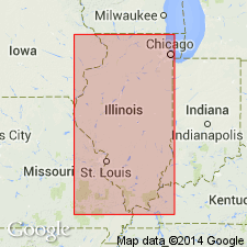
Pg. 471-483. Knobs Megagroup. Name proposed for the body of Devonian and Mississippian clastic rocks of central states, overlying Hunton Limestone Megagroup (new) and underlying main assemblage of limestones of Mississippian age. In Illinois basin, phrase "top of Devonian" in practice means top of Hunton carbonate sequence despite awareness that larger part of overlying New Albany Shale Group is also Devonian. Megagroup names, Hunton and Knobs, are needed to avoid this dual usage of term Devonian. The Knobs is overlain in general conformity by carbonates of Mammoth Cave Limestone Megagroup (new). Boundary is generally older to the west, and younger to the east. There is one major step or arbitrary vertical cutoff in this surface and several minor steps. Major step is from base of Chouteau (Rockford) Limestone of [late] Kinderhookian age to top of western edge of Borden Group of [Osagean] age. In Illinois, this cutoff runs diagonally southwestward from flank of LaSalle anticlinal belt west of Urbana to point about 30 miles south of Springfield, then southward to Mississippi River and Ste. Genevieve fault zone near Chester. Limestone tongues of Chouteau and lenses in the Coldwater extend far east of arbitrary line, and shale tongues of Fern Glen and Warsaw extend westward. In Ohio and West Virginia, the Knobs-Mammoth Cave boundary rises well into [Meramecian], and toward west in Iowa it drops to about base of Kinderhookian. Thickness 400 to 1,000 feet in eastern Illinois; 30 to 300 feet in western Illinois. Term "megagroup" is proposed as formal designation for rock-stratigraphic unit larger than group. Although comparable in size with series and systems, megagroups are defined in terms of lithology and transect boundaries of units that are based on time of deposition. ["Megagroup" not recognized as a formal stratigraphic rank term (ACSN, 1961, 1970; NACSN, 1983, 2005, 2021). Considered informal. The rank or lithologic term should not be capitalized.]
Named for "The Knobs" a narrow band of highly dissected terrain developed on [Late] Devonian and [Early] Mississippian shales that partially surrounds Bluegrass region, and lies in front of Highland Rim, Muldraugh, or Knobstone Escarpment of Kentucky and Indiana.
Source: US geologic names lexicon (USGS Bull. 1350, p. 398-399).

- Usage in publication:
-
- Knobs Megagroup
- Modifications:
-
- Revised
- AAPG geologic province:
-
- Illinois basin
Summary:
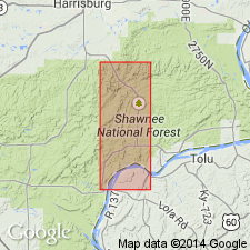
As used in this report, Megagroup includes New Albany Group, Springville Formation, and Fort Payne Formation. [No corroboration of these last two assignments in other reports.]
Source: GNU records (USGS DDS-6; Reston GNULEX).
For more information, please contact Nancy Stamm, Geologic Names Committee Secretary.
Asterisk (*) indicates published by U.S. Geological Survey authors.
"No current usage" (†) implies that a name has been abandoned or has fallen into disuse. Former usage and, if known, replacement name given in parentheses ( ).
Slash (/) indicates name conflicts with nomenclatural guidelines (CSN, 1933; ACSN, 1961, 1970; NACSN, 1983, 2005, 2021). May be explained within brackets ([ ]).

