- Usage in publication:
-
- Knifely Sandstone Member
- Modifications:
-
- Overview
- AAPG geologic province:
-
- Cincinnati arch
Summary:
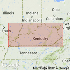
Includes description of lithology and areal extent, and discussion of origin, of Knifely Sandstone Member of Fort Payne Formation. Knifely forms northwest trending body of sandstone that has original dip to the southwest. Long axis of body parallel to and southwest of Borden delta front. Age is Early Mississippian.
[Misprint (US geologic names lexicon, USGS Bull. 1520, p. 168): name misspelled Knifley; and, according to GNU records (USGS DDS-6; GNULEX-Reston, December 15, 1987), Kepferle and Lewis (1974, USGS Bull. 1294-A) named the Knifely.]
Source: GNU records (USGS DDS-6; Reston GNULEX).

- Usage in publication:
-
- Knifely Sandstone Member*
- Modifications:
-
- Named
- Dominant lithology:
-
- Sandstone
- AAPG geologic province:
-
- Cincinnati arch
Summary:
Named Knifely Sandstone Member of Fort Payne Formation. Described as "a very fine grained, silty, argillaceous and dolomitic sandstone that is gray to light gray where fresh." Bioturbated. Contains abundant trace fossils. "Crinoidal debris, poorly preserved gastropods, and brachiopods, are common locally." Forms a northwest-trending body of sandstone that is 25 miles long, 6 miles wide, and as much as 250 feet thick. Sandstone body dips southwestward parallel to the inclosing southwestward-dipping beds of the Fort Payne Formation. Age is Early Mississippian.
Source: GNU records (USGS DDS-6; Reston GNULEX).
For more information, please contact Nancy Stamm, Geologic Names Committee Secretary.
Asterisk (*) indicates published by U.S. Geological Survey authors.
"No current usage" (†) implies that a name has been abandoned or has fallen into disuse. Former usage and, if known, replacement name given in parentheses ( ).
Slash (/) indicates name conflicts with nomenclatural guidelines (CSN, 1933; ACSN, 1961, 1970; NACSN, 1983, 2005, 2021). May be explained within brackets ([ ]).

