

- Usage in publication:
-
- Klutina series*
- Modifications:
-
- Named
- Dominant lithology:
-
- Schist
- Limestone
- Marble
- AAPG geologic province:
-
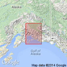
- Alaska Southern region
Summary:
Klutena [later Klutina] series forms most of the mountains about Lake Klutena [Klutina], Copper River region, southern AK. Consists of mica-schists, quartz-schists, sometimes cherty or jaspery in character and crystalline limestone or marble. Marble beds are from 2 to 6 ft thick in vicinity of Sunny Mountain and Mount Carter. Unit is greatly folded in places. Seems to overlie Valdes [Valdez] series (new), which northward seems to pass beneath Klutena [Klutina] series. Age is probably pre-Silurian on basis of resemblance to Fortymile series.
Source: GNU records (USGS DDS-6; Menlo GNULEX).
- Usage in publication:
-
- Klutina group*
- Modifications:
-
- Redescribed
- Age modified
- AAPG geologic province:
-
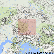
- Alaska Southern region
Summary:
Klutina series of Schrader (1900) is redescribed as Klutina group. Dominant rocks in section east of Chultikana Creek are fine-grained black slate and argillites. Intruded by quartz diorite of Jurassic or younger age. Klutina appears to dip beneath greenstones doubtfully correlated with Lower Jurassic rocks. Age of Klutina is not known. Map legend assigned unit to Carboniferous or older age.
Source: GNU records (USGS DDS-6; Menlo GNULEX).
For more information, please contact Nancy Stamm, Geologic Names Committee Secretary.
Asterisk (*) indicates published by U.S. Geological Survey authors.
"No current usage" (†) implies that a name has been abandoned or has fallen into disuse. Former usage and, if known, replacement name given in parentheses ( ).
Slash (/) indicates name conflicts with nomenclatural guidelines (CSN, 1933; ACSN, 1961, 1970; NACSN, 1983, 2005, 2021). May be explained within brackets ([ ]).