The National Geologic Map Database is migrating to a new infrastructure. We apologize for any service disruptions during this process.
|
|---|


- Usage in publication:
-
- Klawak Formation*
- Modifications:
-
- Named
- Biostratigraphic dating
- Dominant lithology:
-
- Sandstone
- Siltstone
- Limestone
- Conglomerate
- AAPG geologic province:
-
- Alaska Southeastern region
Summary:
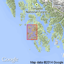
Type locality designated as exposures along west coast of Prince of Wales Island and adjacent small islands along fiord trending north from Klawock to near south entrance of Big Salt Lake, southeast AK. Formation is exposed along axis of a broad syncline that plunges southward from northeast end of Peratrovich Island and includes widely separated exposures of formation in vicinity of Klawock and along Klawak River. Composed of orange-weathering calcareous sandstone and siltstone, minor limestone and chert pebble conglomerate. Thickness is about 500 to 1000 ft. Conformably overlies Peratrovich Formation (new). Upper contact is unknown. Text states age is Early Pennsylvanian. Generalized stratigraphic chart showing comparison of Paleozoic nomenclature shows age as Early and Middle Pennsylvanian.
Source: GNU records (USGS DDS-6; Menlo GNULEX).
For more information, please contact Nancy Stamm, Geologic Names Committee Secretary.
Asterisk (*) indicates published by U.S. Geological Survey authors.
"No current usage" (†) implies that a name has been abandoned or has fallen into disuse. Former usage and, if known, replacement name given in parentheses ( ).
Slash (/) indicates name conflicts with nomenclatural guidelines (CSN, 1933; ACSN, 1961, 1970; NACSN, 1983, 2005, 2021). May be explained within brackets ([ ]).